


3D documentation of Heritage Structures and development of documentation standards - with Taj Mahal as the test bed
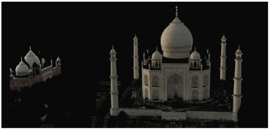
(a) Preliminary work done at Taj Mahal using ILRIS3D
The documentation of heritage structures is currently an important theme and a large number of monuments are being documented world-wide. Special research programmes are being run and promoted by European Union, ISPRS WG/2, CyArk, ScottishTen, CIPA, etc. The laboratory of the undersigned has carried out a few pilot documentation projects over the past few years including Bhitar Gaon, Ajanta Cave no. 17, Kailash Temple at Ellora cave.
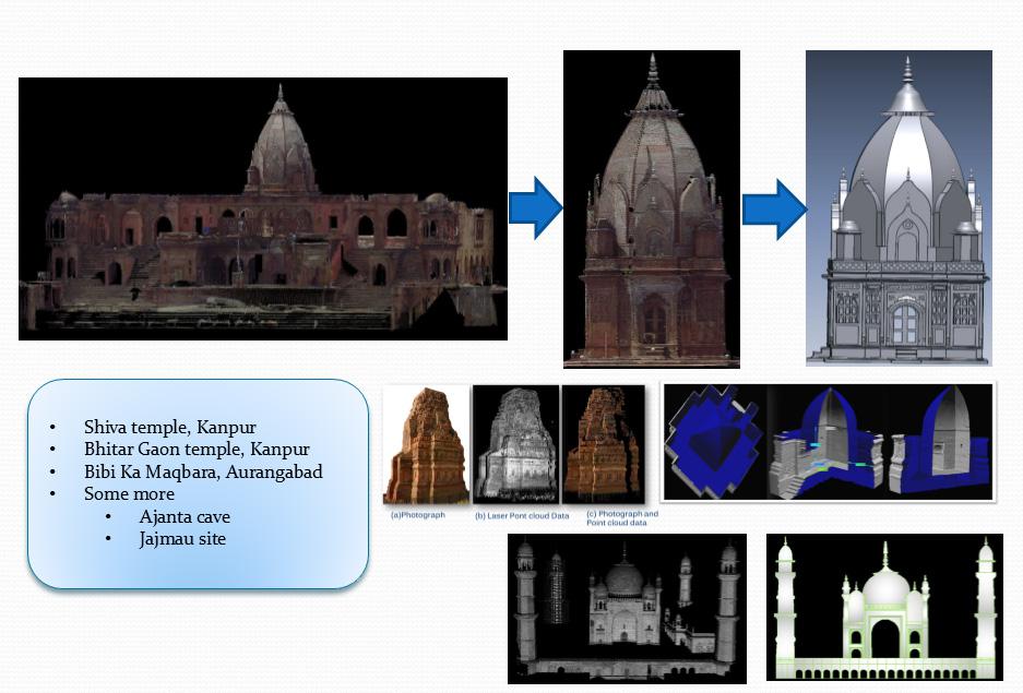
(b) Few examples of laser scanning and modelling work done
While carrying out the documentation of the Taj Mahal using modern technologies, it emerged that exhaustive laser scanning and other surveys need to be conducted at the site in order to generate a comprehensive record of its size, shape, geometry, structure, etc. This data will further be used for analysis of the monument and thus serve as a permanent archive, besides other uses. This will help in understanding why and how were the dimensions of the Taj Mahal chosen by Balasubramaniam (1) and their relationship to other contemporary structures, structural safety and deformation characteristics of structure and to archive data of structure for future maintenance and especially for reconstruction in case of structural damages. Further, this project should serve as a benchmark for all future laser scanning based documentations in India and should result in standards and guidelines.
The main objectives of this project are:
- Development of strategy for documentation of heritage structures.
- Documentation of the Taj Mahal.
- Development of standards for documentation of heritage structures based on the experience gained in this project.
- Use of data for initial structural analysis of the structure and to understand the modular planning in its construction.
Some initial work has already been done at this site as shown in figure(a). The figure shows a laser scan point cloud of the Taj Mahal using ILRIS3D. This preliminary work was also documented by National Geographic in its documentary “Access 360° World Heritage: Taj Mahal”.
ref:
1. New Insights on the modular planning of the Taj Mahal, Current Science, Vol. 97, No. 1. 42-49.