DroneMap

Automatic feature annotation from photogrammetric drone data
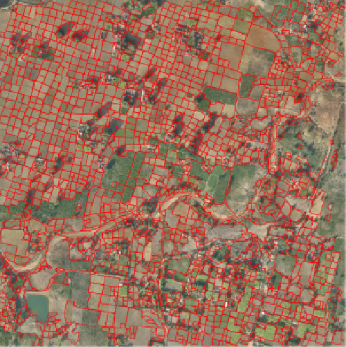
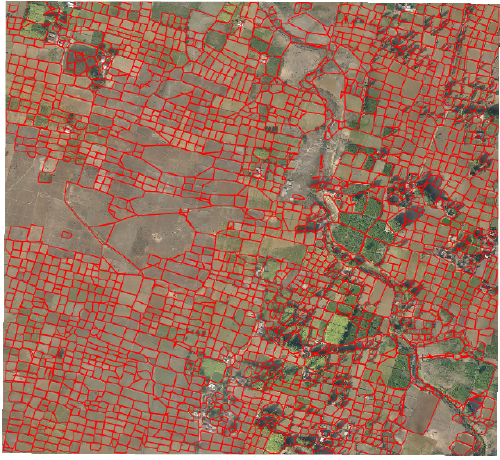
CDIS is building automated feature annotation pipelines for Aarav Unmanned Systems Pvt Ltd. These pipelines can, among other things, automatically recognize land parcel boundaries in rural areas, identify infrastructure damage on national highways, and assess volume of material moved at mining sites. The best part: our pipelines are not data hungry; no supervised learning is involved.