Intranet | Webmail | Forms | IITK Facility
![]()
![]()
![]()
![]()
![]()
GNSS Receivers and Related Instruments
|
|
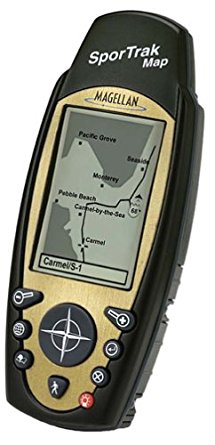
Megellan Sportrak Map GPS The Magellan SporTrak Map brings built-in mapping and expandability within reach of everyone. It is a feature-rich, fun, and easy-to-use GPS receiver that doesn’t compromise on features. Its rugged, waterproof, and ergonomic design is perfect for the budget-conscious outdoorsperson needing a compact but powerful navigator. The large display, along with a front-facing 9-key keypad, makes it easy to use in any environment. SporTrak Map software includes seven graphic navigation screens, storage for up to 500 waypoints and 20 routes, a best fish and game time calculator, and BackTrack for finding your way home after a long trip into the woods. The SporTrak Map runs on two AA batteries for up to 14 hours. It’s housed in rubber-armored, impact-resistant plastic that’s waterproof and also floats. |
|
|
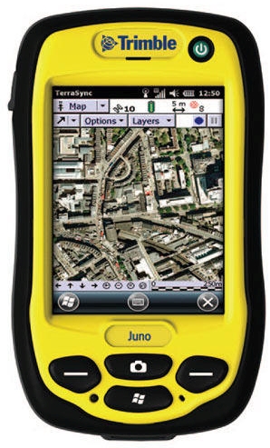
Trimble Juno 3B GNSS Receiver Rugged IP54 rating for tough outdoor conditions. Feature-packed, fully integrated, affordable. 3.75G cellular data and voice capability High-sensitivity GPS receiver. 5 mega-pixel autofocus camera with flash. Long-life battery for all-day use. Lightweight and compact. |
|
|
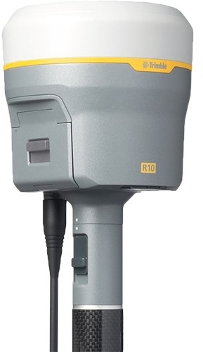
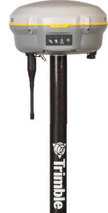
Trimble R10 GNSS Receiver System A cutting-edge Trimble HD-GNSS processing engine. Trimble SurePoint for precise position capture, even with pole tilt off by 15° from plumb, and with 100% data traceability. Trimble 360 for advanced satellite tracking of existing and planned GNSS constellations and augmentation systems-440 GNSS channels. Trimble CenterPoint RTX for RTK level precision anywhere without the need for base station or VRS network. Trimble xFill for RTK coverage even during connection outages. Trimble Access field software and Business Centre office software and technologies. Pair with Trimble TSC3 or rugged Trimble Tablet controller for the most powerful solution on the market. |
|
|
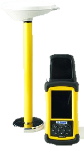
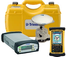
Trimble R3 GPS Receiver System The Trimble R3 GPS system is a complete L1 GPS post-processed solution from the industry leader in GPS surveying technology. Combining an L1 GPS receiver and antenna, rugged handheld controller, and easy-to-use field and office software, the Trimble R3 system brings precise sub-centimeter control to your site, establishes new localized control, and collects topographic data. The system operates without line-of-sight between points, and it can operate day or night in any weather.
|
|
|
Trimble R4 GNSS Receiver System The Trimble R4 is designed for surveyors looking for straightforward GNSS technology that performs under rigorous conditions: 220-channel system with Trimble R-Track satellite tracking technology. Scalable from post-processing to VRS to multi-constellation RTK configurations. The flexibility to choose the level of GNSS support that is perfect for your application. Everything you need to perform a basic survey campaign. Pair with Trimble Access and the Trimble Slate Controller for a dedicated GNSS solution. |
|
|
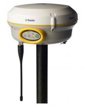
Trimble R8 LT Receiver System The R8s LT is a pre-configuration GNSS system with dual-frequency tracking and base and rover capabilities. The Trimble R8s LT easily integrates with Trimble S-Series total stations. Create a complete solution by combining the Trimble R8s LT receiver with a Trimble controller running Trimble Access field software and Trimble Business Centre office software. |
|
|
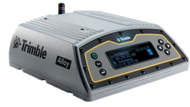
Trimble Alloy GNSS Receiver Trimble’s all-new Alloy GNSS receiver offers powerful performance with the latest GNSS technology in a sleek new design that is easy and intuitive to use. Whether you need GNSS for campaign work or in permanent installations, the flexible configuration delivers reliable, robust data when and where you need it. |
|
|
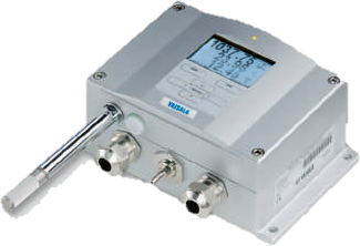
Vaisala PTU300 Meteorological Sensor Vaisala Combined Pressure, Humidity and Temperature Transmitter PTU300 is a unique instrument measuring three parameters simultaneously. PTU300 incorporates sensors known for their high accuracy and excellent long-term stability: Vaisala BAROCAPâ for pressure measurement and Vaisala HUMICAPâ for humidity measurement. The temperature sensor is a platinum RTD sensor. |
|
|
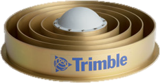
Trimble Choke Ring Antenna The Trimble GNSS v2 choke ring ground plane uses the Jet Propulsion Labs (JPL) design, which is considered the standard of scientific geodetic antenna ground planes. In addition to updating the electronics to improve low-noise amplification and GNSS tracking, Trimble has modernized the GNSS choke ring antenna so that it can track all existing and proposed public GNSS constellations. These include GPS, Glonass, Galileo, Beidou, QZSS, and IRNSS. By improving upon the signal reception characteristics, the GNSS v2 choke ring antennas greatly improve performance in harsh signal environments. |
|
|
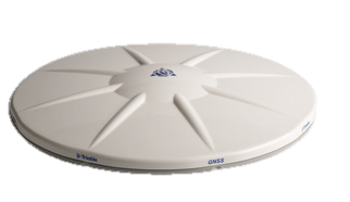
Trimble Zephyr GNSS Geodetic Antennas In the years following the launch of the choke ring antenna, Trimble developed an alternative means of achieving geodetic quality results. Design goals included increasing accuracy and eliminating the frequency-dependent ground plane design. First produced in 2001, the GPS-capable Trimble Zephyr Geodetic antenna was the high-performance result of those efforts. In 2006, Trimble released the next generation Zephyr Geodetic 2, adding full GNSS signal compatibility to the proven Zephyr Geodetic antenna. |
|
|
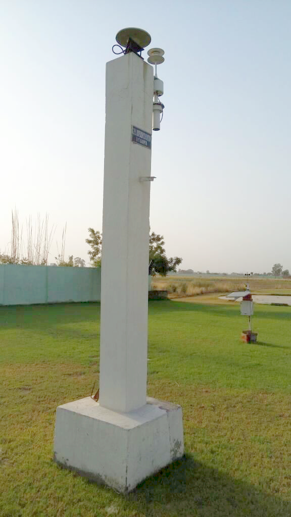
Trimble CORS (IIT Kanpur) Continuously Operating Reference Stations (CORS) eliminate this problem by establishing a common reference frame for aligned control among all users. The repeatable, controlled performance of this advanced solution removes the disparities between user techniques by ensuring all users are using a common reference frame when collecting measurements. Implementation of a permanent reference station reduces errors prone to the use of a temporary base station. Eliminate the repetitive and complex (and often costly) processes associated with a temporary reference station by implementing a permanent reference station network solution. |
|
|
Trimble NetR9GNSS Bundle The NetR9 can be used as a campaign receiver for post-processing, as a Continuously Operating Reference Station (CORS) receiver or portable base station for Real-time Kinematic (RTK) applications, and as a scientific reference station. The Trimble NetR9 receives RTX corrections via either L-Band satellite or IP / cellular, so high accuracy positioning and monitoring applications can be achieved worldwide. The extensive coverage and delivery options provide opportunities in environments where corrections historically have not been available. |