Intranet | Webmail | Forms | IITK Facility
![]()
![]()
![]()
![]()
![]()
Surveying and GNSS Positioning
|
|
The Bernese GNSS Software is a scientific, high-precision, multi-GNSS data processing software developed at the Astronomical Institute of the University of Bern (AIUB). The Bernese GNSS Software provides an environment with high performance, high accuracy, and highly flexible reference GPS/GLONASS (GNSS) post-processing package. State-of-the-art modeling, detailed control over all relevant processing options, powerful tools for automatization, the adherence to up-to-date, internationally adopted standards, and the inherent flexibility due to a highly modular design are characteristics of the Bernese GNSS Software.
|
|
|
Trimble Business Center's field-to-finish survey CAD software helps surveyors deliver high-accuracy GNSS data, create CAD deliverables, and leverage full data traceability throughout a project's lifecycle. Trimble Business Center facilitates managing, processes and creates customer deliverables for all of the official survey tasks with just one software package. |
|
|
Leica Geo Office (LGO) offers the most powerful tools all integrated in one common software to finalize your work faster today and tomorrow. LGO provides Seamless import and integration of data from all instruments including GNSS, Traversing and Level instrument support. It further provides best-in-class processing options for data processing for these instruments along with high end processing options for network adjustments, datum transformations, etc. |
|
|
GAMIT ("GNSS at MIT") is a collection of programs to process phase data to estimate three-dimensional relative positions of ground stations and satellite orbits, atmospheric zenith delays, and Earth orientation parameters. The software is designed to run under any UNIX operating system. GLOBK ("Global Kalman filter") is a Kalman filter whose primary purpose is to combine various geodetic solutions such as GPS, VLBI, and SLR experiments. It accepts as data, or "quasi-observations," the estimates and covariance matrices for station coordinates, Earth orientation parameters, orbital parameters, and source positions generated from the analysis of the primary observations. |


Instruments for Imaging and Ranging
|
|
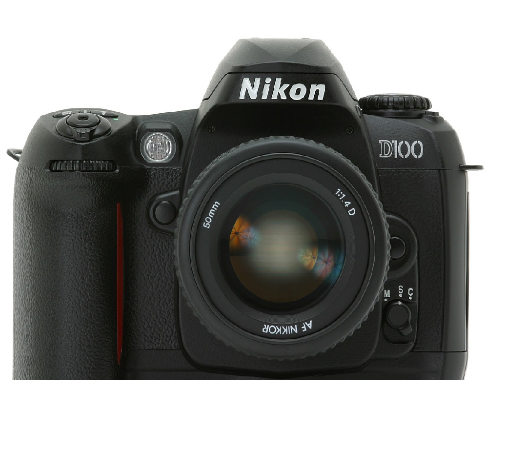
D100 Nikon Camera The D100 has a six-megapixel sensor, a body loosely based on the F80 (although Nikon is keen to note that it shares only some of its components with that camera), a Nikon F mount and a set of features which make it an extremely attractive and capable proposition. |
|
|
GPS/INS GPS/INS is the use of GPS satellite signals to correct or calibrate a solution from an inertial navigation system (INS). Inertial navigation systems usually can provide an accurate solution only for a short period of time. |
|
|
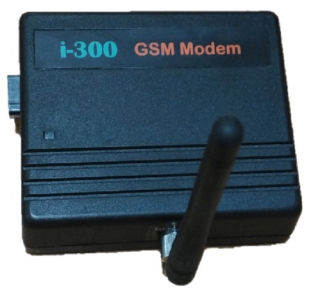
I300 gsm modem I300 gsm modem is a tri-band Gsm modem that supports only 900, 1800, 1900 MHZ band. It has a simple serial interface & can accept any GSM network operator SIM card and act just like a mobile phone with its own unique phone number. The modem can either be connected to the PC serial port directly or to any microcontroller. |
|
|
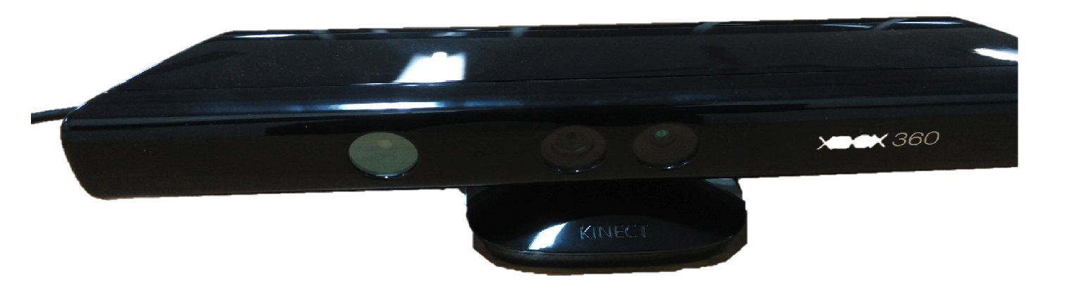
Kinect 360 sensor Kinect 360 sensor is a motion sensor that provides a natural user interface (NUI) that allows users to interact intuitively and without any intermediary device, such as a controller. |
|
|
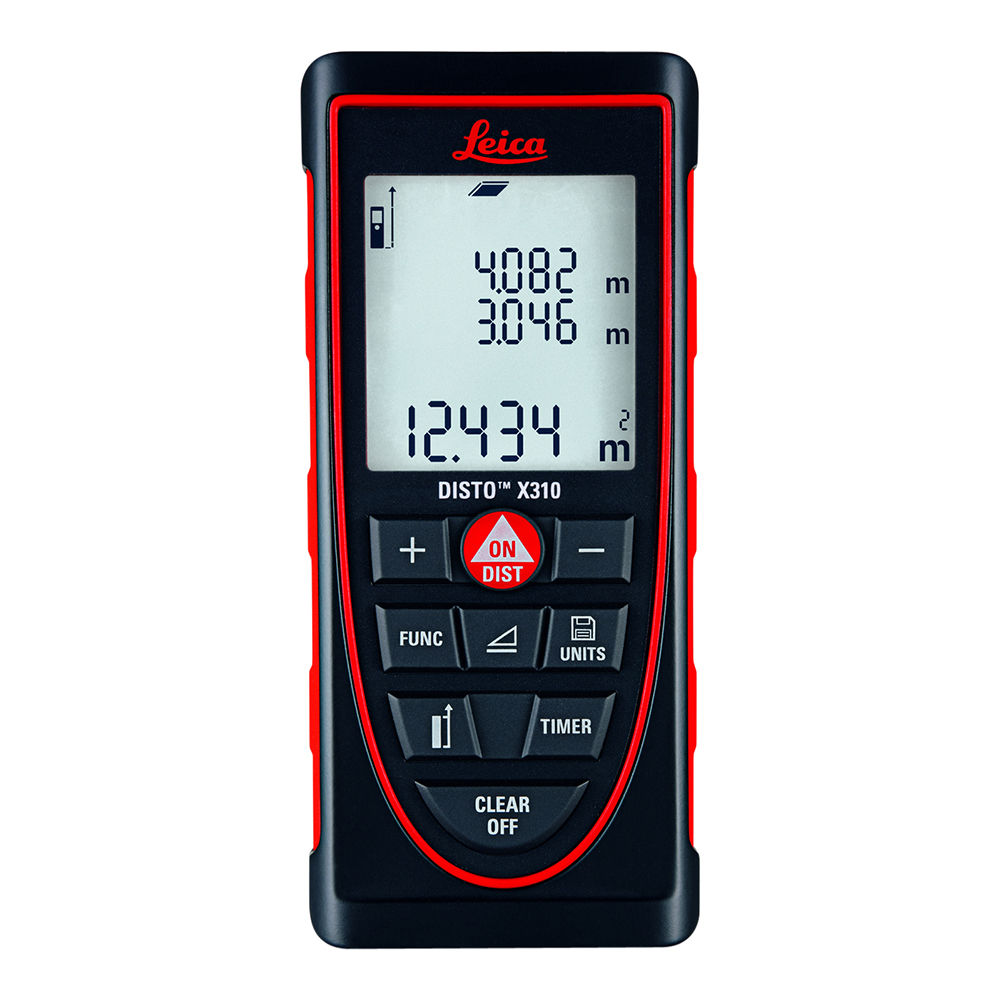
Laser Distance Meter Leica The innovative hand-held laser meter for fast and easy distance measurements of length, squares, and volumes with the press of a button. |
|
|
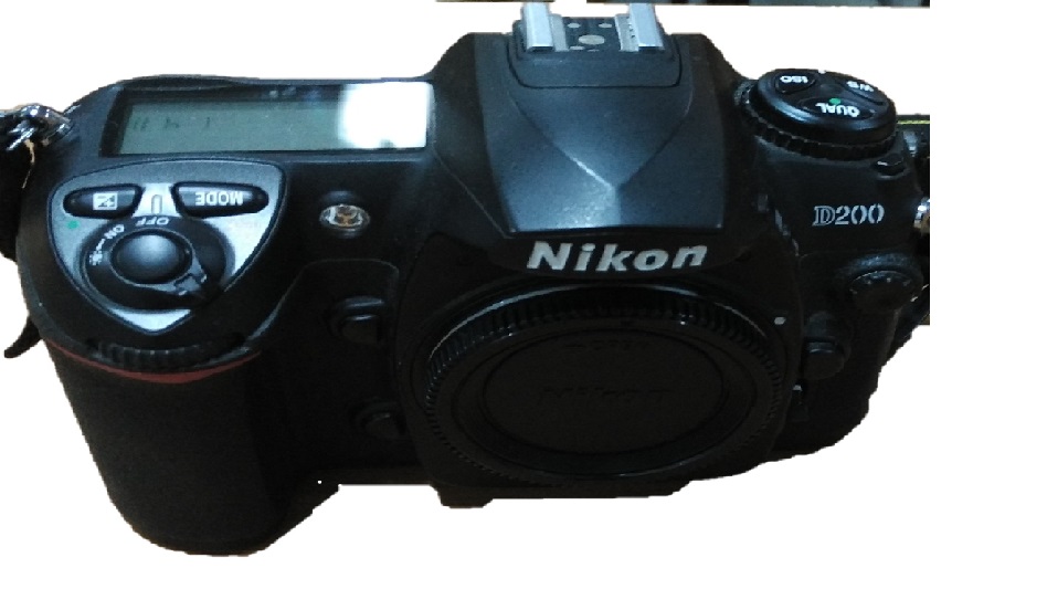
Nikon D200 The Nikon D200 has 10.2 megapixels DX-format CCD image sensor that captures images with edge-to-edge sharpness and incredible color at 3,872 x 2,592 pixels, yielding extraordinarily high-resolution images perfect for enlargements or creative cropping. |
|
|
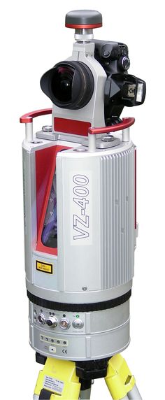
Terrestrial Laser Scanner RIEGL The V-Line 3D Terrestrial Laser Scanner RIEGL VZ-400 provides high speed, non-contact data acquisition using a narrow infrared laser beam and a fast scanning mechanism. High-accuracy laser ranging is based upon RIEGL’s unique echo digitization and online waveform processing, which allows achieving superior measurement capability even under adverse atmospheric conditions and the evaluation of multiple target echoes. The line scanning mechanism is based upon a fast-rotating multi-facet polygonal mirror, which provides fully linear, unidirectional and parallel scan lines. |
|
|
Terrestrial Laser Scanner Optech ILRIS 3D The Optech ILRIS Scan software solution is an all-in-one scanning, viewing, and processing software tool developed for the Optech ILRIS Terrestrial Laser Scanner in partnership with Italian software solutions company Gexcel srl. Combining Optech’s powerful, fully functional ILRIS API with Gexcel’s geomatics experience, ILRIS Scan provides a single interface for the entire survey workflow, from scanning to processing to data review. With ILRIS Scan, you can make your surveys faster, easier, and more efficient than ever before. |
|
|
Velodyne Puck LIDAR Sensor The Puck is a small, compact LIDAR that is optimized for usage across a variety of applications, including automotive, mapping, robotics, security, smart cities and more. The Puck’s reliability, power-efficiency, and surround view make it the ideal solution for affordable low speed autonomy and driver assistance applications.The Puck, built on Velodyne’s ‘558 patent, provides a full 360-degree environmental view to deliver accurate real-time 3D data. |
|
|
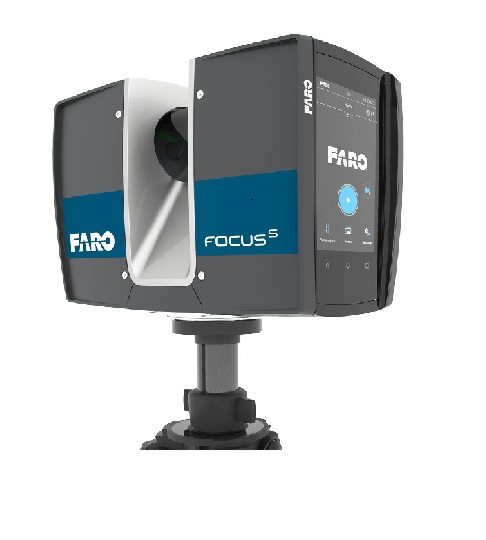
FARO FocusS LIDAR Sensor The FARO FocusS 350/350 Plus is specially designed for outdoor applications due to its small size, extra light weight and extended scanning range. The FocusS 350 provides scanning results even in challenging environments, narrow job-sites, dusty or humid areas, in rain or direct sunlight applications. An on-site compensation tool allows data quality optimization on-site. Integrated GPS & GLONASS receiver enable easy positioning. HDR imaging and HD photo resolution ensure true-to-detail scan results with high data quality. |
|
|
Trimble V10 Imaging Rover 12 calibrated cameras capture 60 MP panorama for full site visualization. Generate Survey, GIS, or mapping accuracy positions from images. Rapid data collection with one-button capture of panoramas. Familiar, easy-to-use workflows in Trimble Access field software. Seamless integration with the Trimble R10 GNSS receiver or Trimble VISION total stations. Flexible, simple processing in Trimble Business Center to generate deliverable. |
|
|
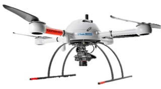
Microdrones At Microdrones, our goal is always to empower you to deliver the best possible work while cutting costs, saving time, and completing projects more easily. mdSolutions were developed with the realities of your job in mind. Our mdMapper packages combine industry-leading UAVs with payloads that were specifically designed for industrial applications like surveying, mapping, inspection, construction, mining, volumetric, and precision agriculture. These packages and kits provide complete solutions that include aircraft, sensors, accessories, custom mounts, and even an Android tablet app that makes it easy to plan, monitor, adjust, and analyze your missions anywhere. |
|
|
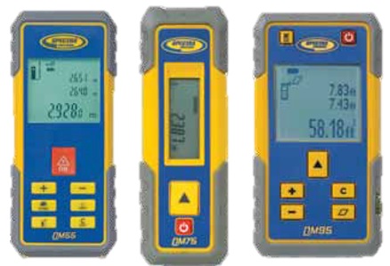
Spectra Precision QM Laser Distance Meters The QM Quick Measure laser distance meters are the first family of distance meters designed specifically for the tough construction site environment. The housing is made of durable engineered plastic with extensive use of protective rubber over mold. The electronics have been cleverly isolated resulting in a product that survives a drop and the typical rough conditions found on job sites. |


RS/GIS Data Processing and Analysis
|
|
ENVI image analysis software is used by GIS professionals, remote sensing scientists, and image analysts to extract meaningful information from imagery to make better decisions. ENVI can be deployed and accessed from the desktop, in the cloud, and on mobile devices, and can be customized through an API to meet specific project requirements. |
|
|
ArcGIS is a geographic information system (GIS) for working with maps and geographic information maintained by Esri. It is used for creating and using maps, compiling geographic data, analyzing mapped information, sharing and discovering geographic information, using maps and geographic information in a range of applications, and managing geographic information in a database.
|
|
|
ERDAS IMAGINE is easy-to-use, raster-based software designed specifically to extract information from images and provides value by consolidating remote sensing, photogrammetry, LiDAR analysis, basic vector analysis, and radar processing into a single product. ERDAS IMAGINE supports enterprise-enabled geospatial image processing that utilizes a centralized relational database to store geospatial information. ERDAS IMAGINE simplifies classification, orthorectification, mosaicking, reprojection, and image interpretation while maintaining the integrity of the geospatial data that is needed for updating a GIS in multiple formats.
|
|
|
The Leica Photogrammetry Suite (LPS) is an integrated suite of digital photogrammetry products that enables users to transform raw imagery into reliable data layers required for all digital mapping, GIS analysis, and 3D visualization. The process-driven workflow of LPS and fast processing speeds increase users' productivity, while the modular design allows users to scale the software to fit their needs. |
|
|
In development for almost three decades, the IDRISI GIS toolset offers over 300 analytical tools for the exploration of our rapidly changing world. Though primarily oriented to the manipulation of raster geospatial datasets, there are traditional tools to meet the needs of the day-to-day GIS professional as well as advanced procedures for complex modeling and analysis. |
|
|
ENVI SARscape now includes easy-to-use tools for some of the most common SAR processing applications -- extending the benefits of SAR data to more users. These tools, ENVI SARscape Analytics, can be accessed in the ENVI toolbox and ENVI Modeler as well as ArcGIS Pro. ENVI SARscape allows us to process and analyze SAR data easily and generate products like DEMs or surface deformation maps while providing the option to integrate this information with other geospatial products. NVI SARscape is integrated with ENVI – the premier image processing and analysis solution. |


Survey Equipment
|
|
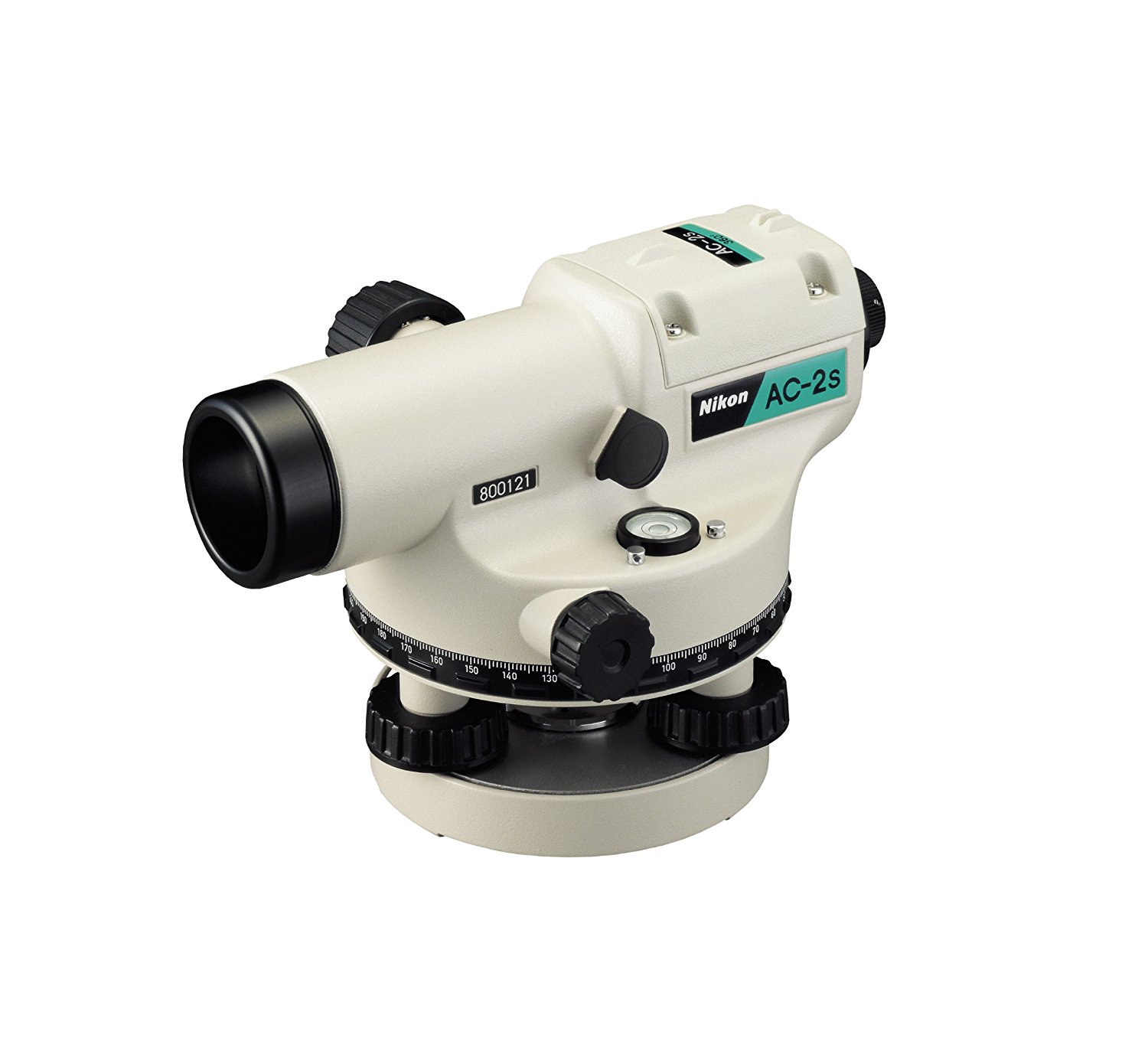
Auto Level Nikon AC-2S Compact, lightweight, and water-resistant, this automatic level features a magnetic-dampened automatic compensator to level the line of sight. Its rugged, water-resistant construction means you can use them in light rain or dusty conditions. This can be attached to both flat- and spherical-head tripods and horizontal tangent knobs with an unlimited range ensure smooth, precise pointing and angular measurement-and you can operate them with either hand. The detachable eyepiece lens lets you use an optional diagonal eyepiece prism for working in extremely close quarters. |
|
|
Digital Level Leica NA2002 The Leica NA2002 Digital Level uses digital electronic image processing for determining heights and distances and records the results automatically in a REC module that can be downloaded to a computer. The accuracy and speed in use are better than a traditional level because it eliminates human error in the reading and the processing of the gathered data. The level can be used for all aspects of highway surveying, for second to fourth order leveling and topographic and construction surveying. |
|
|
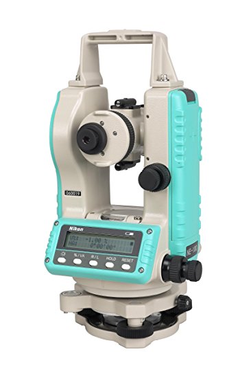
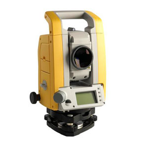
Digital Theodolite Nikon 203S The Nikon 203 electronic digital theodolites from Tripod Data Systems (TDS) deliver a rugged, easy-to-use platform to help you get the job done right. Nikon’s world-renowned optics with a 30x telescope gives you brighter, clearer images. And it’s waterproof, with an IPX6 rating. That means the NE-203 can withstand a powerful jet of water with no harmful effects. So, you can count on reliable performance in tough field conditions. |
|
|
Dini Level The Trimble DiNi Digital Level is a digital height measurement sensor. The Trimble DiNi is a field-proven tool designed for any job site where fast and accurate height determination is required. Use the Trimble DiNi for applications such as precise leveling of flat and sloping surfaces, establishing the vertical component of grade and ground profiles, subsidence monitoring, and establishing the vertical component of control networks. |
|
|
Laser Distance Meter Leica The innovative hand-held laser meter for fast and easy distance measurements of length, squares, and volumes with the press of a button. |
|
|
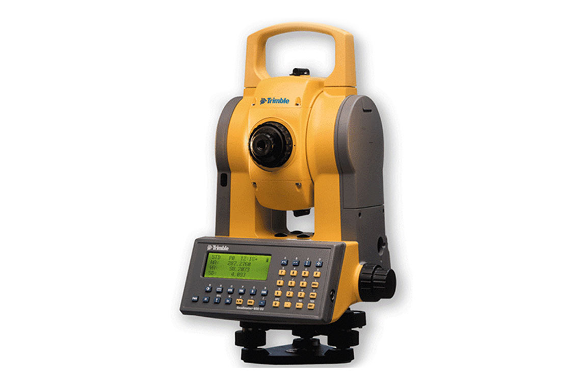
M3 M3 is a mechanical total station that is designed to support your everyday work, including topographic surveys, staking, control, and more. Trimble Access offers a familiar, easy-to-use interface that will ensure your instant productivity with powerful data collection and calculation tools for fast results in the field. |
|
|
Trimble 3600 Series TS The innovative Trimble 3600 Total Station series is designed to optimize your workflow and field productivity. Key features and benefits: Increased Productivity, DR Measurement Mode, Wireless Communications with the Office, and Integrated Surveying. |
|
|
Trimble Robotic TS 5600 Series DR200 The Trimble 5605 DR200+ Direct Reflex Construction Total Station (TS) gives you one of the most accurate, long-range measuring methods available for any measuring situation. A key component of the Trimble Site Positioning System, the 5605 DR200+ total station lets you measure objects that were previously difficult or impossible to reach as safely and easily as those measured with a prism. |
|
|
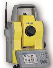
Trimble S8 Total Station Video-assisted robotic measurement utilizing Trimble VISION technology. Visual verification with data overlay and photo documentation. Trimble DR Plus for longer range and fewer setups. Detect targets without interference from surrounding prisms with Trimble FineLock technology. Trimble SurePoint accuracy assurance automatically corrects instrument pointing. Specialized configuration options are available. |
|
|
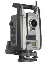
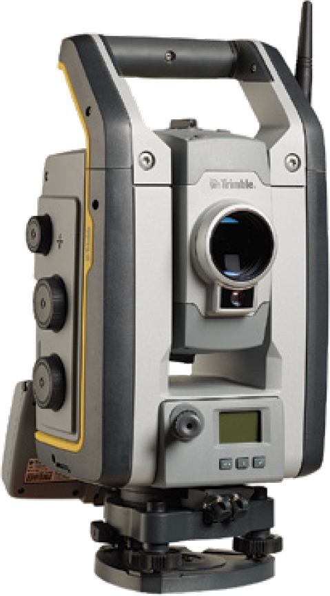
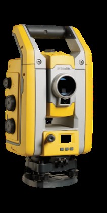
Trimble RS7 The Trimble RS7 Total Station combines scanning, imaging, and surveying into one powerful solution. Now you only need one instrument on the job site to perform all your data capture. Create 3D models, high accuracy visual site documentation, point clouds, and more using the Trimble S7, Trimble Access™ field software and Trimble Business Center office software. |
|
|
Trimble S5 All you need to perform efficient surveying campaigns is available in the Trimble® S5 Robotic Total Station solution: An accurate and reliable instrument, DR Plus EDM, Mag Drive™ technology, the popular Trimble TSC3 Controller with Trimble Access™ field software and quick data processing with Trimble Business Centre office software. |

LiDAR Data Processing
|
|
TerraScan is a dedicated software solution for processing laser scanning point clouds. It can easily handle millions of points as all routines are tweaked for optimum performance. Its versatile tools prove useful for a number of application fields, such as transmission lines, flood plains, proposed highways, stockpiles, forest areas, city models, road and railroad surveying, and much more. TerraScan is fully integrated with MicroStation. This CAD environment provides a huge number of useful tools and capabilities in the areas of view manipulation, visualization, vector placement, labeling and plotting. |
