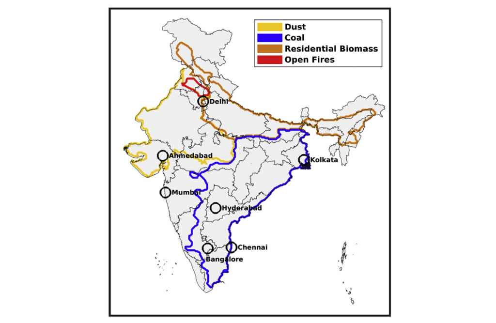
Airshed
An airshed is a part of the atmosphere that behaves coherently for the dispersion of emissions. It is an important technique for Air Quality (AQ) monitoring because it integrates meteorology, climatology, topography, and landscape information over any geographical boundary to create a local/regional/global air quality assessment. The airshed over India is defined using a combination of major cities (populations > 3 million inhabitants), sensitivity simulations, and satellite-based PM2.5 estimates. To identify coherent regions with similar PM2.5 characteristics, the sensitivity simulations perturbed primary PM2.5 sources in India (Brauer et al., 2019). High resolution spatial AQ data from dense Sensor Ambient Air Quality Monitor (SAAQM) networks in rural areas of UP & Bihar will be used to create micro airsheds within the state so that the AQ at the district level can be effectively managed by understanding the contribution from the different sources within the micro airshed (i.e., industries, vehicles, etc.) and also sources within the larger airshed. The airshed planning processes depend on three factors, i.e., Problem identification, Plan development, and Implementation and reporting.
Problem Identification includes the selection of harmful air pollutants and stakeholders. Plan development includes collecting all emission data, air pollution modelling (dispersion, receptor, and statistical modelling), and setting long-term AQ goals, priorities, strategies, and actions. Implementation and reporting include implementation of the plan, plan drafting and sign-off, progress, and review process.