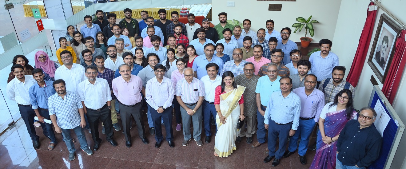
Faculty
Research
Publications
Admissions
Welcome Message

Welcome to the Department of Earth Sciences at IIT Kanpur. We are one of the youngest department in the country, established in 2014, with a vision to carry out interdisciplinary Earth Science teaching and research of contemporary relevance....
- Read More
-Prof. Debajyoti Paul
Head, Department of Earth Sciences
BS-MS Programme in Earth Science :
Students with 10+2 level PCMB will be admitted through JEE as per the standard procedure. The total number of seats available would be 15-20 to start with.
Course structure and Course content
Program Template
BS-MS Programme courses download the entire content in pdf
ESO213A: Fundamentals of Earth Sciences Universe and its characteristics
Course Content: Solar System and Earth; The primitive Earth; Geological Time scale; Origin of life and major geological events; Numerical Dating. Rocks, minerals and soils; Plate Tectonics and Mountain building; Deformation and Geodynamics; Earthquakes, Volcanoes. Earth, Ocean, Land, Rivers, Atmosphere, Biosphere, Cryosphere and Climate; Energy budget; Carbon Cycle; Hydrological Cycle; Weathering and erosion. Coupled processes in Earth System; climate change, Geological resource (minerals, hydrocarbons and water); Sustainability and Anthropocene activities.
DC-1 Mineralogy and Crystallography (ES311)
Course Content: Chemical and physical properties and identification of common rock-forming (silicates, carbonates and oxides) minerals; crystallography, Unit cells, Crystal symmetry, classes and rotation, Systems, Plane and Bravais Lattices, Axial Ratios, Parameters, Miller Indices, Point Groups, Crystal Form, Zones, Crystal Habit, Stereographic Projection of Crystal Faces, Polymorphs and Pseudomorphs, Twinning; optical mineralogy, uniaxial, biaxial minerals; introductions to x-ray crystallography; crystal structures, chemistry, and origin and significance of the rock-forming minerals, Mineralogy of the Earth's crust, upper mantle, lower mantle and its Core.
Lab-work: Identification of minerals and rocks (hand specimens and optical microscopes). Independent projects that will include operation of scanning electron microscope, electron microprobe and x-ray facilities.
DC-2 Field Geology I (ES312)
Course Content: This course will provide an introduction to field work activities (3-4 days), how to use a Brunton Compass, reading of topographic maps, dip and strike measurements, and basics of lithological mapping.
DC-3 Geomorphology and Earth Surface processes (ES313)
Course Content: Fundamental concepts of geomorphic system; Earth's energy balance, global heat transfer, topography and bathymetry, liberation and flux of sediments, hydrological cycle and water budget. Guiding Principles of earth's surface processes: Conservation, transport rules, event size and frequency; rates of processes and ages of landscapes. Whole Earth morphology and large-scale topography; Exogenic and endogenic processes. The Surface water system: Drainage basins and river systems, river morphology and hydrology, hydraulic geometry and governing principles of open channel flow; river processes and landforms, river dynamics. The Groundwater system: Groundwater in hydrological cycle, groundwater flow and storage; chemistry of groundwater. The Atmospheric System: Atmospheric composition and mixing, atmospheric circulation, greenhouse effect. The Ocean and Coastal system: Coastal environment, waves, tides and currents; The relative movement of land and sea; coastal processes and landforms. Cryosphere – growth and decay of ice sheets, controlling factors, Himalayan glaciers; Wind activity and geomorphic work, desertification and controlling factors. Global geomorphology and tectonics: Earth's physiography and landscape evolution; Landforms and tectonics of plate margins and plate interiors; Tectonic uplifts and denudation – rates and controlling factors, Sea level change – evidence, mechanism and effects; coupled tectonic-surface process models.
DC-4 Fundamentals of Geophysics (ES314)
Course Content: Introduction to geophysics, Earth as a planet and member of the solar system, origin and evolution of the Earth, Internal structure of the Earth; Concept of plate tectonics, plate motions and triple junctions; Gravitation, gravity anomalies and its variations, geoid, isostasy, rheology; Geomagnetic field, its origin and variations, paleomagnetism, and geomagnetic reversals; Introduction to seismology, seismic waves - P, S and surface waves, seismograph, travel time curves and radial Earth structures, general properties of surface waves and normal modes, earthquake source theory, intensity and magnitude scales of earthquakes, PREM model, elastic rebound theory, global seismicity and tectonics, focal mechanisms, seismic anisotropy; Heat within the Earth, thermal structure of continental and oceanic lithospheres at subduction zones and spreading centers, mantle convection.
DC-5 Igneous & Metamorphic Petrology (ES315)
Course Content: This course will introduce igneous and metamorphic rocks and focus on the processes and principles involved in the generation of these rocks in a wide range of tectonic settings. Emphasis will be on developing skills necessary to understand and evaluate melt generation and crystallization, differentiation and chemical evolution of magma, and metamorphic processes etc. Topics to be discussed in detail are: Classification and Nomenclature of Igneous Rocks; Textures and Petrogenetic Interpretations; Thermodynamic evaluation of phase diagrams, Phase Diagrams for Binary and Ternary Systems; Chemical Petrology: Major and minor element, and isotopic compositional variations; graphical and mathematical models of magma evolution; Fractionation of trace elements during melting and crystallization; Generation and diversification of magmas; Types of metamorphism; Classification of metamorphic rocks; textures; Metamorphic mineral assemblages and chemographic (ACF, AKF, and AFM) diagrams; Metamorphic Facies; Metamorphic Reactions. Laboratory exercises will focus on hand-specimens and thin sections (optical microscopy) characterization, igneous and metamorphic textures and petrogenesis interpretations.
DC-6 Structural Geology (ES411)
Course Content: Concepts of deformation and structures in Earth and planetary systems; Concepts of Continuum, Solid, Fluid, Tensor, Force, Stress and Strain; Basics of rheology and deformation mechanisms; Structures associated with extensional, compressional, sliding tectonics and erosion; Fold morphology, kinematics and mechanism; Normal, reverse, oblique and strike-slip faults; Fold and thrust belts; Measurement and presentation of 1-, 2- and 3D structural elements; Ductile shear zones; Poly-phase (superposed) deformation and overprinting relationships; Application of Structural Geology.
Lab-work: Measurement and presentation of structural elements; Stereographic projection and interpretation; Construction and interpretation of structural map, profile and balanced cross section; measurement of finite strain; studying structures under optical/electron microscope.
DC-7 Sedimentary Processes and Stratigraphic Principles (ES412)
Course Content: Basinal Sedimentary Systems : Sedimentary basins and production of sediments; Transport of sediment grains; depositional processes and forms; Post-depositional changes-lithification and diagenesis. Sediment grain, Bedforms and Sedimentary Structures: Mechanics of sediment transport and transport laws; Grain size parameters and distribution, grain shape and form; primary grain fabric; Bedforms & inorganic primary sedimentary structures. Sedimentary Facies analysis: Concept of sedimentary facies; facies relationships; controlling factors; facies association and models; Fluvial environments and facies; Lacustrine facies, Deltaic environments and facies models. Clay Sedimentology: Origin of clay minerals, clay minerals in fluvial, aeolian and lacustrine environments, paleoenvironmental interpretations. Techniques in clastic sedimentology: Grain size determination; X-ray diffraction; Heavy mineral analysis; cathodoluminescence microscopy. Earth's history in rock record, stratigraphic principles – lithostratigraphy, cyclostratigraphy, chronostratigraphy, event stratigraphy; depositional models, accommodation space seismic and sequence stratigraphy; Magnetostratigraphy, Application of paleomagnetism to the solution of problems in stratigraphic correlation and to the construction of a high-precision geological timescale, climatic and tectonic controls on stratigraphic development, case studies.
DC-8 Geochemistry (ES413)
Course Content: This course will focus on the chemical evolution of the Earth over geological time, and how chemical principles are used to study Earth Science.The following topics will be covered: internal structure of atoms, electronic structure, chemical bonding, and chemical properties of elements. Fundamnetals of Thermodynamics and its application in Earth Sciences. Aquatic geochemistry, primary silicates and chemical weathering, acids and bases, dissolution and precipitation reactions, mineral stability diagrams, Eh-pH diagrams, oxidation-reduction reactions. The origin and evolution of Earth and the solar system through high temeparture chemical processes, trace elements in igneous processes, modeling trace element partition during magma genesis. Radiogenic isotope geology and geochronology. Stable isotope geochemistry. Earth's hydrosphere and its interaction with surficial rocks, sediments, soils, biosphere and the atmosphere.
DC-9 Field Geology II (ES414)
Course Content: General overview of geological structures in the field; Concept of orientation and scale in the field; Identification, measurement and presentation of different structural elements (lineation, cleavage, foliation, schistocity etc.) and their mutual relationships. Morphology and elements of folds, fractures, faults, shear zones and macrostructures; Strain analysis from deformed objects; Techniques and ethics of geological samples collection; Large and small scale litho-structural mapping (on topo-sheet and white paper), cross-sections, and their interpretation for regional tectonics.
DC-10 Geological Remote Sensing and GIS (ES415)
Course Content: Spectra of earth's surface material; Basic principles of digital image processing – point and algebric operations, filtering and neighbourhood processing, RGB-HIS transformations, image fusion analysis, PCA, image classification and geometric operations; Modern platforms and techniques - INSAR techniques and its applications, UAV, and airborne sensors. Basic principles of Geographic Information System (GIS) and its application – decision support and uncertainty, multi-criteria evaluation. Remote sensing applications - River basin management, groundwater prospecting, lake and wetland studies, water quality mapping, vegetation Mapping and forestry applications; applications in glaciology and snow hydrology; snow cover mapping and prediction of snowmelt runoff; Coastal zone mapping and other related applications; Natural hazards – floods, landslides, earthquakes; Mineral resources evaluation.
DC-11 is a course in Civil Engineering (CE361)
Course Content:
DC-12 Exploration Geophysics (ES416)
Course Content: Introduction to exploration geophysics;Gravity and Magnetic methods: History of gravity-magnetic explorations, elementary theories of gravity and magnetic methods, densities and magnetic susceptibilities of rocks and minerals, brief on gravimeters and magnetometers, data reductions, gravity-magnetic anomalies, interpretation and applications; Electrical and electromagnetic methods: Electrical properties of rocks and minerals, self potential and its origin, concepts of D.C. resistivity, various electrode configurations for sounding and profiling, interpretation of resistivity field data, induced polarization; Basic concept of EM induction, Maxwells equations, different EM methods, earth's natural electromagnetic field, magneto-tellurics, various applications of EM; Seismic methods: Basics of seismic theory, Geometry of seismic wave paths, seismic events, reflection and refraction methods, seismic data acquisition system, convolutional model, basic processing steps, basic velocity-depth modeling, interpretation of seismic data; Radiometric methods: Principles of radioactivity, radioactivity of rocks and minerals, measuring instruments and applications; Well logging: Borehole environment, concepts of porosity, permeability and saturation, principles of electrical, nuclear, density and sonic logging and well log interpretation.
Laboratory classes will provide hands-on experience with different geophysical instruments.
DC-13 Geological Evolution of Indian Plate (ES417)
Course Content: Overview of geologic and tectonic evolution of the Indian plate, major geologic and tectonic features of the Indian sub-continent, Geodynamics and major structural grains in the Indian sub-continent; Indian Mountain-buildings in geological time and space; Cratons (Dharwar, Singbhum, Bastar, Bundelkhand, Aravalli etc.) and their development in the Archean; Proterozoic basins (Chhatisgarh, Cuddapah, Marwar, Pranhita-Godavari and Vindhyan), Gondwana basin; Rifting, drifting, palaeomagnetic interpretation and the evolution of India's continental margins; The concept of Large Indian Provinces in global context; Rajmahal and Deccan volcanic provinces; Plateau uplift (Deccan, Tibet and Shillong); Phanerozoic stratigraphic records of peninsular India; The Himalaya mountains; northward flight of India and collisional orogenesis; Classification of the Himalayan ranges; Himalayan foreland development and Indus-Ganga-Brahmaputra plains.
DC-14 Field Geology III (ES418)
Course Content: The course is designed to provide practical experience in stratigraphy including field logging of stratigraphic sections, sedimentary facies identification and description, interpretation of sedimentary processes, depositional environments, post-depositional changes; soil profiles and soil-forming processes. The students will also be taught geophysical data acquisition using available geophysical equipments (e.g., gravimeter, magnetometer, VLF electromagnetic equipment, resistivitimeter equipment, GPR, Seismic, and Global positioning system).
Distribution of credits in BS-MS Program
| BS PROGRAMME IN EARTH SCIENCES | ||||
| I Semester | II Semester | |||
| S: MTH 101 | 3-1-0-0 (11) | S:MTH 102 | 3-1-0-0 (11) | |
| S: PHY 102/PHY 103 | 3-1-0-0 (11) | S: PHY 103/PHY 102 | 3-1-0-0 (11) | |
| S: PHY 101/CHM 101 (Lab) | 0-0-3-0 (02) | S: CHEM 101/PHY 101 (Lab) | 0-0-3-0 (03) | |
| TA: TA 101 | 2-0-3-0 (09) | ES: ESC 101 | 3-1-3-0 (14) | |
| S: LIF 101 | 2-0-0-0 (06) | S: CHM 102 | 2-1-0-0 (08) | |
| HSS: ENG 112/HSS-1 (Level 1) | 3-1-0-0 (11) | MPCFL: PE 102 | 0-0-3-0 (03) | |
| MPCFL: PE 101 | 0-0-3-0 (03) | |||
| Total | 54 | Total | 50 | |
| III Semester | IV Semester | |||
| ES: ESC 201: Electronics | 3-1-3-0 (14) | HSS: HSS-2 (Level 1) | 3-1-0-0 (11) | |
| ES: SO-1: Introduction to Earth Sciences | 3-0-0-0 (09) | S: SO-2: Probability & Statistics | 3-1-0-0 (11) | |
| ES: ESO-2: Fluid Mechanics | 3-1-0-0 (11) | DC-3: Geomorphology & Earth Surface Processes | 3-0-0-0 (09) | |
| DC-1: Mineralogy and Crystallography | 3-0-2-0 (11) | DC-4: Fundamentals of Geophysics | 3-0-0-0 (09) | |
| TA: TA 201 (MSE) | 1-0-3-0 (06) | DC-5: Igneous & Metamorphic Petrology | 3-0-2-0 (11) | |
| MPCFL: Composition (web) | 0-0-2-0 (02) | TA: TA 202 (ME) | 1-0-3-0 (06) | |
| DC-2: Field Geology I | 0-0-3-0 (03) | |||
| Total | 56 | Total | 57 | |
| V Semester | VI Semester | |||
| ES: ESO-3: ESO202: Thermodynamics | 3-1-0-0 (11) | DC-10: Geological Remote Sensing | 2-0-2-0 (08 | |
| DC-6: Structural Geology | 2-0-3-0 (09) | DC-11: Hydrological system analysis/Engineering Hydrology (CE361) | 2-0-0-0 (06) | |
| DC-7: Sedimentary processes & stratigraphic principles | 2-0-2-0 (08) | DC-12: Exploration Geophysics | 2-0-2-0 (08) | |
| DC-8: Geochemistry | 2-0-0-0 (06) | HSS: HSS-3 (Level 2) | 3-0-0-0 (09) | |
| DC-9: Field Geology II | 0-0-6-0 (06) | OE-1: Open Elective | 3-0-0-0 (09) | |
| DE-1: Departmental Elective (Eco. Geology) | (08-11) | OE-2 : Open Elective | 3-0-0-0 (09) | |
| MPCFL: Communication Skill | 0-0-2-0 (02) | |||
| Total | 50-53 | Total | 49 | |
| VII Semester | VIII Semester | |||
| DC-13: Tectonics and Evolution of Indian Plate | 2-0-0-0 (06) | DE-4/UGP-3 | (8-11) | |
| DE- 2: Departmental Elective | (08-11) | OE-5: Open Elective | 3-0-0-0 (09) | |
| DE -3: Departmental Elective | (08-11) | OE-6: Open Elective | 3-0-0-0 (09) | |
| OE-3/UGP-2 | 3-0-0-0 (09) | HSS: HSS-5 (Level 2) | 3-0-0-0 (09) | |
| OE-4: Open Elective | 3-0-0-0 (09) | DE-5: Departmental Elective | (08-11) | |
| HSS: HSS-4 (Level 2) | 3-0-0-0 (09) | |||
| DC-14: Field Geology III | 0-0-4-0 (04) | |||
| Total | 53-59 | Total | 43-49 | |
| MS PROGRAMME IN EARTH SCIENCES | ||||
| IX Semester | X semester | |||
| DE-6: Departmental Elective | (08-11) | MS Thesis | (63) | |
| DE-7: Departmental Elective | (08-11) | |||
| DE-8: Departmental Elective | (08-11) | |||
| DE-9: Departmental Elective | (08-11) | |||
| DE-10: Departmental Elective | (08-11) | |||
| MS Thesis | (09) | |||
| Total | 49-64 | Total | 63 | |
Notes: A student will be allowed UGP-3 only if he has done UGP-2.
Distribution of courses and credits (BS PROGRAMME)
| Course Group | Group Code | Total credits (Min) |
% of total credits | ARC recommendation (% of total credits) |
| HSS (excluding Management, comm. skills etc) | HSS | 49 | 11.9 | 10 |
| Science (including electives)1 | S | 75 | 18.2 | 20 |
| Engineering Science (Esc, ESO etc.) | ES | 59 | 14.3 | 10 |
| Technical Arts | TA | 21 | 5.1 | 5 |
| Management + PE + Communication Skills + Foreign Language | MPCFL | 10 | 2.4 | 5 |
| Core courses (Mandatory) | DC | 104 | 25.2 | 25 |
| Electives2 | DE | 40 | 9.7 | 10 |
| Open Electives2 | OE | 54 | 13.1 | 15 |
| Total | 412 | 100 | 100 |
1. Minimum credits; may increase depending on the courses chosen by the student.
List of departmental electives and specializations (BS-MS PROGRAMME)
| (a) Applied Geology | Structure | Credits |
| Geology of Fuels | 2-0-2-0 | 08 |
| Economic Geology (DE-1) | 3-1-0-0 | 11 |
| Mineral Exploration Methods | 3-0-0-0 | 09 |
| Engineering Geology and Hydrogeology | 2-0-2-0 | 08 |
| (b) Water and climate | ||
| Ecohydrology (CE619) | ||
| Earth, Life and Sustainability | 3-0-0-0 | 09 |
| Global Climate Change (ES646) | 3-0-0-0 | 09 |
| Atmospheric Physics and Chemistry (EEM613) | ||
| (c) Applied Geophysics | ||
| Geophysical Field Theory | 2-1-0-0 | 08 |
| Seismic Exploration & Subsurface Imaging | 2-1-0-0 | 08 |
| Inverse Theory & Data Assimilation | 2-1-0-0 | 08 |
| Well logging | 2-1-0-0 | 08 |
| (d) Solid Earth Geology | ||
| Rheology of Earth | 3-0-0-0 | 09 |
| Analytical methods in Earth Science | 2-0-3-0 | 09 |
| Isotope geochemistry | 3-0-0-0 | 09 |
| Geodynamics | 3-0-0-0 | 09 |
| (e) Natural Hazards | ||
| Quaternary geology and tectonic geomorphology | 3-0-0-0 | 09 |
| Disaster Mental Health (PSY 794) | ||
| GPS and Geodesy (CE674) | ||
| Disaster Management and Risk Mitigation | 3-0-0-0 | 09 |
In addition, the students will be encouraged to take electives from outside the department as and when available.
Preamble
The IIT Kanpur is starting a new undergraduate program in the Earth Sciences from July 2016. The students qualified in JEE will be admitted in this program which has been designed as a highly quantitative and diverse in nature with a strong focus on modern tools and methods being used across various industries. Some of the important sectors include oil and gas, mineral exploration, non-conventional energy, water management, natural resource management and disaster mitigation. The program is highly interdisciplinary in nature, utilizing the methods and principles of all basic sciences namely Chemistry, Physics, Mathematics, and with several overlaps with engineering discplines such as Material Sciences and engineering, civil engineering and Mechanical Engineering. For example, Chemistry comes into picture while studying rocks and minerals, Physics is at play every time an earth Scientist tries to "peep inside" the earth by looking at the variation of Magnetic and Gravitational field of earth. Similarly, methods and tools developed in Mathematics and Computer Science are indispensable for an Earth Scientist trying to predict the Monsoon. Mechanical Engineering and Material Sciences come into play while studying the mechanical property like strength, ductility, hardness etc. Thus Earth Science is an all-encompassing field trying to address a varied range of problems and employing tools and technique from a diverse set of fields. At the same time, this discipline offers an opportunity to solve multitude of problems which our society is facing including water scarcity, climate change and natural disasters such as floods, landslides, earthquakes and tsunamis.
What is Earth Sciences?
Earth Science is a strongly interdisciplinary subject with several links to fundamental science pillars like Physics, Chemistry, Mathematics and Biology. The subject links important resources such as minerals, energy, and water, as well as to hazards and environmental management. Over the years, this discipline has developed into a major knowledge domain of science and technology due to the advent of modern space observation systems, new exploration technologies for probing earth's surface and sub-surface for resources, and the development of sophisticated geochemical analytical methods. In addition, several important issues such as climate change, natural hazards, environmental degradation and resource depletion have made this science highly relevant to the society.
Why should I study Earth Sciences as Major?
Some of you may have never been exposed to this subject formally in your school days. Having said that, as you live and perform your daily activities using the resource and energy derived from Earth, you certainly are familiar with the topic and have questions in your mind that you could not answer. Let's consider a few examples –
- In 2015 you must have felt few earthquakes that happened in the Himalaya. You know why earthquake happens by some keywords, like tectonic plate, tectonic force, collision, release of energy, fault etc. etc. If you study earth science you can go much deeper with your understanding using the integrated knowledge of science and know what is the origin of the plates, why do they move at all, when and where should the earthquake happen again?
- You probably know that the rocks at the summit of Mt. Everest have fossils which used to live in the deepest part of an ancient ocean. How did it travel from the deep-ocean to the top of the world? Earth Science is the subject to answer such questions.
- The electricity or any form of energy, water, all the metals, building materials, ceramics are the integrated parts of our daily life. The earth is the supplier of all these and the resource is limited. Will our future generations be able to access and use them? You need to be an Earth Scientist to answer the question and help the community to plan accordingly.
- When you stand on the ground and look up to the sky, the science and technology is now so developed that it can answer many questions about the space and cosmos. However, if you want to go below your feet, unfortunately, we have virtually no direct access after maximum 1-2 km given the radius of the Earth is about 6400 km. What is there in the deep earth? How does it behave? Does a change in the deep earth influence our daily life and future? The subject Earth Science is waiting for you.
There are many such examples and the list is never-ending. In general, Earth Science studies are critically important to modern society. An understanding of the rocks and minerals that make up the solid Earth, and how these materials interact with the atmosphere, the world water supply, and living organisms provides the foundation for all natural and environmental sciences. All of these factors are critical for understanding how the Earth has changed in the past and how it may change in the future.
Is Earth Science a quantitative, qualitative or descriptive subject?
It is true that Earth Science has been taught in a descriptive in most universities across the country, but the modern trends and innovation in this science have brought several quantitative aspects in this subject. Our BS-MS program in Earth Sciences has been designed to capture some of these modern developments which have utilized the fundamentals of physics, chemistry, mathematics and biology to understand the dynamics of the interior of the Earth in past and present time and the phenomena associated with ocean and atmosphere. In several sub-branches of Earth sciences such as geophysics, structural geology, hydrology, and petrology a sound quantitative knowledge is essential. For example, solid earth geophysics explains the shape, interior structural details, tectonic forces, magnetic and gravity fields associated with the Earth, whereas structural geology describes the mechanics of the surficial processes and their links with the underlying tectonic activities. To understand all these phenomena geophysicists and structural geologists follow advanced quantitative tools including continuum mechanics, thermodynamics, fluid dynamics, acoustic, gravity and electromagnetic principles, statistics, numerical modeling, optimization techniques, scientific parallel computing and so on. A blend of all these aspects is commonly used to generate models of the Earth's internal structure and its evolution with time at different scales. As a whole doing Earth Sciences is a great fun where you can utilize your analytical and quantitative skills to understand your mother Earth in a better way.
What should be my background to study Earth Sciences?
Science, in general, with a curious mind. Practicing Earth Science is very similar like the job of a detective. All the clues are around you and you have to search for it. Using the tools of science and logic the Earth Scientists try to reconstruct the history of the Earth and predict the future. In addition, if you are fun-loving, like to explore the nature with a different view and perspective, then your background is certainly suitable to study Earth Sciences.
If you like Physics, the branches of Geophysics, Geomechanics, Geodynamics, Structural Geology etc. are there to explore. Is Chemistry your passion? A person specialized with Geochemistry or Petrology (chemistry of rocks) is in high demand in industry and academia. If solving critical differential equations and general mathematics are your favorites, we welcome you to guide us in building the analytical and numerical models to solve several interesting problems. And if you are fascinated with the exciting world of animals and plants, you are the best one to solve the missing links in our evolution.
Why should I study Earth Sciences in IIT Kanpur?
There are many brilliant institutes, universities and colleges in India, which offer Geology and Earth Sciences courses. The key features of the Department of Earth Sciences of IIT Kanpur that should attract you for your undergraduate studies are –
- It is a new department and therefore the course curricula is significantly modern with a special emphasis on the applied and fundamental topics of Earth Sciences.
- For the same reason, that the department is new, we are flexible and ready to grab whatever comes exciting on our way.
- The faculty members of the department are highly qualified and experts in their own domain with significant international exposure and recognition. Moreover, the department has an excellent blend of young and experienced faculty members who are passionate in teaching. We also frequently invite the best scientists and teachers from India and abroad to teach specialized topics.
- One of our teaching goals is to provide hand-on training on the modern instruments apart from building theoretical framework through lectures. Several newly built laboratories in the department host sophisticated instruments and facilities of international standards and a few of them are unique in India.
- Finally, the brand "IIT Kanpur" makes the difference particularly for your future job and academic opportunities.
What is the general structure of the BS-MS programme in Earth Sciences in IIT Kanpur?
The structure of the BS-MS programme in Earth Science is similar to other BS and BT programs being offered at IIT Kanpur. The first two semesters are devoted to the core courses in basic sciences and engineering, which are common across all disciplines. The third and fourth semester involves some core courses common across all departments together with some departmental courses. Similar to other departments, fifth and sixth semester involve many departmental courses together with some departmental and open electives. Last two semesters mainly comprise of departmental and open electives, thus making the program academically flexible. Students are also required to take five courses in Humanities and Social Sciences in line with other programs. Keeing in view that Earth Science is primarily a field science, the department has taken special care to design several field-based courses which involve training outside the campus to observe, map and measure the natural processes in action. In addition, the MS part of the programme will involve thesis work on a well-chosen problem of Earth Sciences and the department expects high quality research output using the learnings from the BS programme.
The Earth Science department has designed five modules within the BS-MS programme namely, (a) Applied Geology, (b) Water and climate, (c) Applied Geophysics, (d) Solid Earth, and (e) Natural Hazards. Each of these modules includes a set of specialized courses but cross-fertilization across the modules will be encouraged. A brief description of each of these modules is as follows:
- Applied Geology - mainly deals with application of geology for various applications such as mineral and fuel exploration, movement and distribution of groundwater, soil erosion, and other environmental problems related to water and sediment pollution.
- Water and Climate - involves the study of all water related issues including rivers, glaciers, groundwater and oceans as well as the climate change issues involving atmosphre-hydrosphere interactions; also includes impacts of climate change on water-resources, agriculture and ecology.
- Applied Geophysics – applies the principles of physics to study the internal processes of earth such as earthquakes, tsunamis and landslides as well as for exploration of natural resources; involves the use of various tools such as magnetic, electromagnetic, gravity and seismics many of which are indispensible for exploration industries related to oil and gas, groundwater and minerals.
- Solid Earth – includes geological and geophysical aspects of the solid earth invloving its planetary evolution, geodynamics, mantle dynamics and rock deformation.
- Natural Hazards - aims to study natural hazards such as landslides, floods, earthquakes and tsunamis affecting the humanity to understand the controlling processes and mitigation strategies. This module has a strong societal relevance and offers huge opportunities to understand the vagaries of nature.
What are the detailed course structure, course contents and credit distributions of this course?
You may visit https://www.iitk.ac.in/es/list-of-courses-bs-ms-programme
Can any prospective student come to visit?
Yes, all prospective students are welcome to visit the department and interact with our faculty members and senior students. This will greatly help in making up their mind.
Any financial aid available?
Yes, DST INSPIRE fellowship should be available as per the DST guidelines.
What kind of physical fitness I need to be in the field trip and who supports the field training?
Since there are several field-based courses as a part of the BS-MS programme, a basic physical fitness is essential. However, no specialized field skills are required. In case of any medical problems, the students should report this to the instructor beforehand. All expenses related to travel and logistics for field trips are supported by the department.
What is the career opportunity after studying Earth Sciences?
The students graduating from the department of Earth Sciences will be invaluable to the industry due to interdisciplinary and quantitative nature of the program. The students are expected to be recruited by the energy industry, construction industry, industries involved in mineral exploration, environmental industries and space industries, including satellite tracking and meteorology and hurricane tracking. Students will also have career opportunity in Public Sector Unit (PSU) like Geological Survey, Coal India, ONGC and Mineral Exploration Corporation Ltd.
Students of the BS-MS programme in Earth Sciences will also have excellent opportunities to opt for academic and research careers. The undergraduate program in Earth Sciences will also prepare students for higher studies in post graduate programs within and outside India. Most of the leading universities in the world have postgraduate as well as undergraduate programme in Earth Sciences. The students graduating from the Department of Earth Sciences at IIT Kanpur will be the new breed of Earth Scientists of this country and the graduates will find excellent employment in a competitive global economy and will also contribute towards Earth Sciences research.
Does the department encourage extra-curricular activities?
The department supports a vibrant Earth Science Society run and managed by the students. Activities of the Society include social and cultural events, popular lectures, sports activities and other events, which facilitate to build a better academic and social environment in the department.