Faculty
Research
Publications
Admissions
Welcome Message

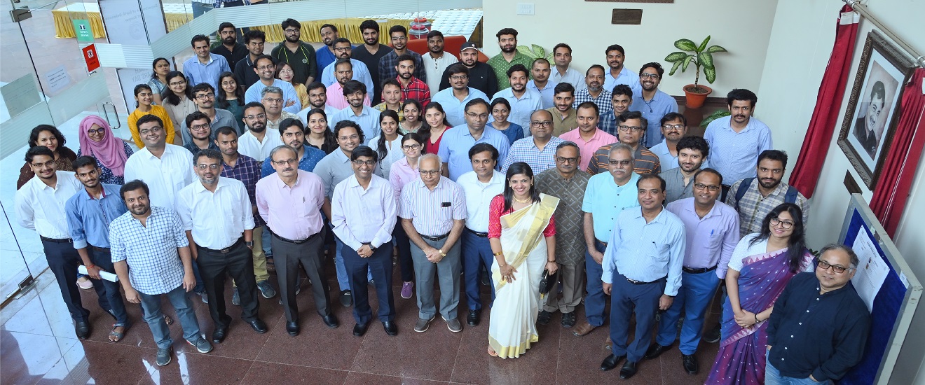
Welcome to the Department of Earth Sciences at IIT Kanpur. We are one of the youngest department in the country, established in 2014, with a vision to carry out interdisciplinary Earth Science teaching and research of contemporary relevance....
- Read More
-Prof. Debajyoti Paul
Head, Department of Earth Sciences
M.Tech in Geological Technology
M.Tech. Programme in Geological Technology (4 Semesters) has a focus on applied Earth sciences and specialized courses in earth surface processes, climate science and natural hazards. The programme consists of 2 semesters of course work and two semesters of research. The M.Tech. students are expected to complete 8 courses in the first two semesters with a minimum CPI of 6.0 and then carry out research in one of the specialized areas for the next two semesters. A written thesis has to be submitted and defended at the end of the programme.
The programme aims to provide high quality manpower in Earth Sciences, where intellectual foundations and traditions are anchored in the (a) integration of quantitative data across various earth systems, and (b )application of geological, geophysical and other related analytical methods. Some of our major research areas include river science, natural hazards, environmental geology, hydrocarbons, water and soil chemistry and climate change. The Department encourages however interdisciplinary research and innovative ideas in all possible areas of Earth Sciences.
Who Can Apply?
Students with M. Sc. degree in Earth Science streams or B. Tech. /B. E. degree in Civil/Geosciences Engineering are eligible to apply for the M.Tech programme. Candidates having M. Sc. degree in other science streams may also be considered. In addition, a valid GATE score will be needed. The GATE requirement will be waived for the B.Tech graduates from IITs with a minimum overall CPI of 6.5 and a minimum CPI of 8.0 in the last two semesters in B.Tech. However, such students are not entitled to Institute Assistantship if the overall CPI is below 8.0.
PhD Programme in Earth Sciences aims to develop high quality research programmes in areas of crust mantle interaction, hydrology, soil formation, climate change, energy, natural hazards with an emphasis on interdisciplinary and quantitative approach. The PhD programme also consists of a combination of course work and independent research.
PhD in Earth Sciences*
PhD Programme in Earth Sciences aims to develop high quality research programmes in areas of crust mantle interaction, hydrology, soil formation, climate change, energy, natural hazards with an emphasis on interdisciplinary and quantitative approach. The PhD programme also consists of a combination of course work and independent research.
All PhD students are expected to complete a specified of number of credits through course work after which the student must clear a comprehensive (written and oral) examination before he/she is admitted to the candidacy of the PhD programme. Subsequently, the candidate is required to deliver a "State of the Art" Seminar on his/her area of research. All PhD students are expected to carry out independent research and are encouraged to present research findings in conferences and publications. Prior to completion, the candidate is required to deliver an "Open Seminar" following which he/she is allowed to submit the thesis and appear for the thesis oral examination.
Who Can Apply?
M.Sc. / M.Tech. degree or equivalent in Earth Science streams with CPI/marks not below 6.5 or 65% or Bachelor's degree in engineering with CPI/marks not below 7.5 or 75%. Valid GATE/UGC/ CSIR score is required for financial assistance, except for graduates from IITs with a minimum CGPA of 8.0. The candidates with DST INSPIRE fellowship for PhD are also eligible.
A. OVERVIEW OF THE COURSE STRUCTURE FOR M. Tech. PROGRAM
TABLE 1: Course structure and distribution of credits in M. Tech. Program
| Minimum Total Credits | Min. Credit Through Course Work | Min. Credit Through Research | Min. Duration | Max. Duration |
|---|---|---|---|---|
| 144 | 54 | 63 | 4 Semesters | 4 years |
TABLE 2: Semester wise course distribution for M.Tech degree
| Semester I DC1: Mathematics for Earth Sciences. DC2: Remote Sensing & GIS for Geo-resource evaluation. DC3: Introduction to Profession & Communication Skills in Earth Sciences. DE1: Elective DE2: Elective |
Semester II DC4: Geophysical methods. DC5: PG seminar in Earth Sciences. DE3: Elective DE4: Elective DE5: Elective |
| Semester III THESIS (36 credits) |
Semester IV THESIS (36 credits) |
*DC: Departmental Compulsory Course, DE: Departmental Elective Course
TABLE 3: List of Departmental Elective Courses (PG level)
|
1. Active Tectonics and Paleoseismology 2. Advanced Structural Geology 3. Advance Metamorphic Petrology 4. Applied Hydrogeology 5. Applied sedimentology and Basin Analysis 6. Aqueous Geochemistry 7. Experimental Rock mechanics and Rock physics 8. Geodynamics 9. Geology and Geochemistry of petroleum 10. Instrumentation in Earth Sciences 11. Isotope Geochemistry and Applications |
12. Mineral Resource Exploration 13. Natural Hazards 14. Non-Traditional Stable Isotope Geochemistry 15. Physics of Earthquakes 16. Planetary Geomorphology: Processes and Landforms 17. Potential field theory in applied geophysics 18. River Science 19. Rock Magnetism 20. Seismic Exploration & Subsurface Imaging. 21. Solid Earth Geophysics 22. Quaternary Geology and Tectonic Geomorphology |
*Among these DE courses some of them may be offered in a particular semester depending on the availability of the expertise in the department.
B. OVERVIEW OF THE COURSE STRUCTURE FOR PhD PROGRAM
TABLE 4: Course structure and distribution of credits in Ph.D. Program
| Academic Program | Min. Credit Requirements | Min. Credit Through Coursework | Min. Credit Through Research work | Minimum Duration | Maximum Duration |
|---|---|---|---|---|---|
| Ph.D. with M.Tech | 144 | 36 (4 courses) | 72 | 4 semesters | 6 years |
| Ph.D. with master's degree except M.Tech | 180 | 54 (6 courses) | 72 | 5 semesters | 6 years |
| Ph.D. with bachelor's degree | 216 | 72 (8 courses) | 72 | 6 semesters | 7 years |
- There are two compulsory courses for Ph.D. students:
- ES600A [1-0-0-0(3)]: Introduction to profession and communication skills in Earth Sciences.
- ES702A [0-0-0-0(0)]: PG Seminar in Earth Sciences.
- PhD students should take ES702A for two times or two semesters during their PhD duration. At least for one time, they must complete this course before appearing for the comprehensive examination.
- The Ph.D. students should opt only for PG-level They may opt for courses in other departments based on the supervisor’s and/or doctoral monitoring committee (DMC)’s recommendation.
- Ph.D. students must finish with the required minimum course credits and CPI (as per PG manual) before appearing for the Comprehensive examination.
*Ph.D. students can opt for any PG level (DC and/or DE) courses as mentioned under section A to fulfil their course requirements.
C. OVERVIEW OF THE REGISTARTION PROCESS
- A student is required to register for I semester, II semester and summer term for each academic year.
- Registration involves:
- Pre-registration through PINGALA portalfor the courses/thesis credits that he/she intends to pursue in that semester/term.
- Payment of fees for that semester/term and clearance of any outstanding dues, and signing the registration roll with the office of the Dean of Students Affairs (DOAA).
- The normal semester load is defined as equivalent of 36 credits. For a well merited case the SPGC may permit a student to register for a maximum of 45 creditsor a minimum of 27 credits.
- A student is required to register in the summer term for up to a maximum of half the normal semester load (i.e., 18 credits) and a minimum of 9 credits.
PLEASE REFER TO IIT KANPUR PG MANUAL FOR MORE DETAILS ON ACADEMIC REQUIREMENTS AND OTHER RELATED GUIDELINES
PhD and M.Tech. courses download the entire content in pdf
Active Tectonics and Paleoseismology (ES659) [9 credit]
Course Content: Crustal deformation and earthquakes; Significance of seismicity; Identification of Prehistoric Earthquakes based on Primary and Secondary signatures preserved in landforms and sediment succession; Interpretation and Identification of Active Fault and associated Tectonic Landforms – Photogeologic Mapping, on-fault and off-fault landforms, identification and mapping of active faults and associated landforms in field, structural analysis of active faults & its implication to regional scale tectonics; Field Techniques in Paleoseismology, quantification of active fault scarp by precise mapping, identification of old (prehistoric) earthquake by trenching, mapping of deformed sedimentary succession by faulting, estimation of net displacement during single event, slip rate, magnitude of historic earthquake, recurrence interval, and prediction of future earthquake if possible; Identification and mapping of secondary effects due to strong seismic shaking – Identification of paleo-liquefaction features; Dating techniques; Correlation of paleoseismic data with existing geodetic and geophysical data; Delineation of seismogenic faults. Paleo-tsunami geology – Identification of Paleo-tsunami and Mega-subduction zone earthquakes signatures in the coastal region along subduction zones; Understanding land-level change caused by major earthquakes; decoupling the role of climate and tectonics; Understanding the effect of near-field and far-field earthquakes from stratigraphic records; effects of near-field and far-field tsunami.
Advanced Structural Geology (ES654) [9 credit]
Course Content: Introduction and methods of quantitative Structural Geology; Force and stress fields in Earth; Displacement and strain; Stress and Strain tensors; Mohr Circles; Geological analysis of field data (stereographic analysis and cross section construction); Strain analysis from deformed rocks; Stress-Strain-Time relationship under different conditions; Failure Mechanism; Deformation mechanisms and Rheology of cataclasis, crystal-plasticity and dissuasive mass transfer; Role of fluids and Fluid flow; Deformation in Brittle, Ductile and Brittle-Ductile transition; Structural anatomy and strength profile of tectonic boundaries; Applications.
Advance Metamorphic Petrology (ES662) [9 credit]
Course Content: Basics of petrology; Rock classifications; Structures and textures of rocks; Metamorphic Facies; Magmatism and metamorphism at various tectonic settings with associated rock-types and mineral assemblages. Electron microprobe, EPMA data processing, Ideal mixing activity, Mineral formula and Endmember calculations. Metamorphic stable mineral assemblages; Projections; Gibbs free energy; Phase rule, Metamorphic reactions; Mineral equilibrium; Influence of compositional variations. Geothermobarometry; Schreinemakers method; Petrogenetic grid; Phase diagrams; P-T-t paths, Thermochronology. Metamafics and Metaultramafics: Assemblages, Facies series; Metamorphism of felsic rocks; Metapelites: Barrovian sequence; Metacarbonates and metacalcareous rocks; Fluid inclusions; Metasomatism; Tectonic significance. High-pressure (HP) and High-temperature (HT), Ultra high-pressure (UHP), Ultra high-temperature (UHT) metamorphism: P-T ranges, textures, Mineral assemblages, Mineral chemistry and Tectonic setting. Metamorphism in plate boundaries; Collisional tectonics. Using petrological datasets; linking petrology with field information, structure, geochemistry and geochronology; Petrogenesis and tectonics interpretations. Case studies and examples on metamorphic evolution, P-T history; petrogenesis and tectonic setting of some global and Indian metamorphic terranes.
Applied Hydrogeology (ES666) [9 credit]
Course Content: Role of water in Earth’s climate; Hydrological cycle and its components; Monitoring of hydrologic storages and fluxes; Water budget computations; Water-bearing properties of rocks - porosity, intrinsic permeability, specific yield and specific retention; Vertical distribution of sub-surface water; Classification of aquifers; quantitative assessment of aquifer properties; Aquifer parameters: transmissivity, hydraulic conductivity and storage coefficient; Determination of permeability in laboratory; Concept of heterogeneity and anisotropy; Characteristic differences between confined and unconfined aquifers; Hydrostatic pressure; Fluid potential; Energy in groundwater; Hydraulic head; Theory of groundwater flow; Darcy's law and its applications; Specific discharge; Limitations of Darcy’s Law; Reynolds Number; Governing equation for flow through porous medium; Steady and non-steady state flow - Initial and boundary conditions; Solution of flow equations; Dupuit’s Assumption; Boussinesq Equation; Groundwater flownet analysis; Groundwater flow patterns, Groundwater-Surface water interactions; Determination of flow direction. Flow through aquifers: 2-D groundwater flow equations; Flow under steady and non-steady state conditions; Evaluation of aquifer parameters of confined, semi-confined and unconfined aquifers - Thiem, Theis and Jacob methods.
Applied Sedimentology and Basin Analysis (ES653) [9 credit]
Course Content: Introduction to applied sedimentology, Siliciclastic, Carbonate, Phosphates, Iron-rich and Evaporite sediments and their economic significance; Physical properties of sediments – density, porosity and permeability, field and laboratory methods of their determination (rock physics properties); Sedimentary Basins- Basin-forming mechanisms; Basins due to lithospheric stretching, flexure and strike-slip; classification and evolution of sedimentary basins; Metallogeny, and Petroleum system in sedimentary basins; Major external controls on sedimentation; Continental sedimentary environments; Marine sedimentary environment; Basin fills and stratigraphy; Subsidence and Thermal history; Sediment to rock - the Subsurface Environment.
Aqueous Geochemistry (ES643) [9 credit]
Course Content: Course will primarily cover (1) the quantification of key geological processes controlling the chemical composition of water, precipitation and dissolution of certain minerals, and fluid–mineral interaction; (2) Chemical principles of weathering and its effects on water chemistry; (3) application of stable and radioisotopes to understand the source, pathways, and age of water; (4) contaminant geochemistry of some elements. Detailed topics to be discussed are: chemical thermodynamics and kinetics, aqueous complexation, acids and bases, redox geochemistry and Eh-pH-pE diagrams, carbonate geochemistry, chemical weathering, adsorption-desorption reactions, tracing of water cycle, controls on water chemistry, groundwater dating, and contaminant geochemistry.
Communication skills in Earth Sciences (ES650) [0 credit]
Course Content: This course is mainly designed to improve the presentation skills of our students. Any topic in Earth Sciences, including geochemistry, geophysics, structural geology, environment and climate change, sedimentology etc., can be selected a based on the expertise of the instructor.
Experimental Rock Mechanics & Rock Physics (ES657) [9 credit]
Course Content: Introduction and historical development; Principles and terminologies; Sensors, transducers and their calibrations; Design of deformation apparatus, safety features; Selection, preparation and dimension of samples; Uniaxial, biaxial, triaxial and torsion test set-up; Rock mechanics at room and high pressure temperature; Rate dependent rheology; Role of porosity, pore-fluid, grain size and mechanical anisotropy; Collection and processing of experimental data; Understanding stress-strain and related curves; Calculation of flow-laws, effective-viscosity and frictional properties; Mechanics of crystalline and porous rocks; Recovery and post-processing of deformed samples for further physical and chemical analysis; Measurement of electrical; thermal and hydraulic (liquid and gas) conductivity of rocks; Techniques of ultrasonic pulse transmission (Vp-Vs) and acoustic emission; Applications and limitations.
Geodynamics (ES667) [9 credit]
Course Content: The course is designed to understand the dynamics, flow of mass and energy of solid Earth in a quantitative manner. It contains Kinematics of Plate Tectonics - Earth’s structure, hotspots and mantle plumes, convergent, divergent and transform plate boundaries, plate motion on flat and sphere Earth; Basics of Elasticity and Flexure – body and surface forces; stresses in 2D and 3D; isostasy, linear elasticity, uniaxial stress and strain, pure and simple shear, 2D bending or flexure of plates, application to Earth’s lithosphere; Heat transfer - Fourier’s Law of heat conduction, Earth’s surface heat flux, 1D and 2D heat conduction with advection, basics of thermochronology, frictional heating on Faults; Fluid mechanics - 1D channel flow, pipe flow, Asthenospheric Counterflow, mantle convection, diffusion of groundwater; Faulting - classification of faults, friction on faults, Anderson theory of faulting, thrust sheets and gravity sliding, earthquakes.
Geophysical Methods (ES656) [9 credit]
Course Content: Introduction to different geophysical methods; Concepts of gravity and magnetism, working principles of measuring instruments, field operations, micro-gravity survey, gravity and magnetic gradiometry, data reductions, regional-residual separation, direct and indirect interpretation and applications; Elementary theories of DC resistivity, resistivity surveying equipment's and different arrays, interpretation of electrical sounding and profiling data, IP measurements in time and frequency domains, applications of SP methods; EM induction theory, time and frequency domain EM, EM systems for ground, marine and airborne surveys, working principles of VLF, MT and GPR and their applications; Theory of elasticity and wave propagation, concept of rays, ray paths in layered media, principles of marine and land seismic sources and receivers, land and marine seismic data acquisition techniques, data pre-processing - static corrections, multiple attenuation techniques, filtering and processing steps – NMO, velocity analysis, stacking, migration, interpretation of migrated sections, basics of Tomography and AVO; Principles of well logging, Archie’s law, different petro-physical parameters, different logging techniques and interpretation of field log data.
Geology and Geochemistry of Petroleum (ES647) [9 credit]
Course Content: History of petroleum and gas exploration in India; Carbon cycle, origin and preservation of organic matter-the source material of petroleum; Oil and gas bearing rocks, reservoir rocks, trap and seal rocks- the petroleum system key components; Petroleum generation, migration, and accumulation- the petroleum system processes; Composition of crude oil and oilfield water – upstream and downstream linkages; Multiple controls on petroleum biodegradation and impact on oil quality; Classification of oil and gas accumulations; Geochemical screening of source rocks and petroleum - total organic carbon, petrographic analysis of macerals, vitrinite reflectance, elemental analysis of kerogen, rock eval pyrolysis, thermal alteration index, organic biomarkers, trace metals, carbon isotopes, and radiogenic isotopes; Application of geochemical tracers in petroleum exploration. Age of oil deposits, oil-oil correlation and oil-source correlation techniques, reservoir compartmentalization issues, identification of oil-bearing horizons and reservoir rocks from geochemical logs, and reservoir filling history; Unconventional oil and gas resources. Oil shales, tar sands, and gas hydrates; Petroliferous basins of India. Case studies on specific oil producing Indian basins; Petroleum and environment; future of hydrocarbon resources.
Instrumentation in Earth Sciences (ES648) [9 credit]
Course Content: Near subsurface mapping using Ground Penetrating Radar (GPR) – mapping of buried structures, depth determination of underground bodies and lithounits; Generation of Digital Elevation Models (DEM); Landform mapping using Total Station, Integrated TS-GPS system and by Real Time Kinematic (RTK) survey; Field training including geological mapping; X-Ray Diffraction – sample preparation and interpretation of XRD charts for qualitative and semi-quantitative analysis of crystalline materials; Principles and theory of Scanning Electron Microscopy (SEM); Sample preparation, coating, imaging and analysis; X-Ray Fluorescence – sample preparation and semi quantitative and quantitative chemical analysis of geological samples; sample-acid digestion and chemical analysis by Inductively Coupled Plasma Mass Spectrometry (ICP-MS).
Isotope Geochemistry and Applications (ES649) [9 credit]
Course Content: Nucleosynthetic processes and the isotopic abundances of elements, Decay mechanisms of radioactive atoms, Equations of Radioactive Decay and Radiogenic Growth, Geochronology using radioactive decay schemes of Rb-Sr, Sm-Nd, U-Th-Pb, K-Ar, U-series disequilibrium method of dating, 14C dating, Fission track Dating, Analytical methods in Thermal Ionization Mass Spectrometry, Isotope Geochemistry of the Earth's Mantle and crust, Isotopic evidence regarding the formation of the Earth, Stable Isotope Theory, Kinetic and equilibrium isotope fractionation, Analytical methods in Stable isotope ratio mass spectrometry, Specific applications of stable isotopes in hydrology, climate and environment, archaeology and paleontology, Carbon cycle and climate.
Mathematics for Earth Sciences (ES651) [9 credit]
Course Content: Introduction to importance of mathematics in Earth sciences, Basics of MATLAB; Vector analysis, Grad, Div, Curl, application of Gauss’s Theorem to potential methods and seismology; Matrix analysis, Matrix inversion for the solution of simultaneous equations; Coordinate systems: Curvilinear coordinates, Cartesian, Cylindrical, and Spherical coordinates, Applications of coordinate systems to Plate motion, (non) seismic; Complex analysis in geosciences; Tensor analysis and its application to (non) seismic and geodynamics; Ordinary and partial differential equations, separation of variable, numerical solution to Heat diffusion equation; different data types in Earth sciences, methods of data analysis: Univariate Statistics, Empirical distributions, theoretical distributions, statistical tests (χ2, Kolmogorov-Smirnov and Kuiper tests), Bivariate and multivariate Statistics, Correlation coefficient, linear regression analysis, bootstrap estimates, Data modeling, best fit, fitness evaluation; Multiple correlation coefficients; basics of geophysical signal processing.
Mineral Resource Exploration (ES671) [9 credit]
Course Content: Introduction to mineral exploration; stages of mineral exploration, crustal abundance and geochemical behaviour of the elements; geochemical anomalies; geochemical cycle: primary dispersion, secondary dispersion; pathfinder/indicator elements; geodynamic settings of mineral deposit systems; different types of ore deposits and their metallogeny, surface and subsurface mineral exploration methods, analytical techniques in mineral exploration, ore reserve estimation, national mineral policy, Indian mineral deposits, prospecting techniques for base and strategic metals.
Natural Hazards (ES658) [9 credit]
Course Content: Natural Hazards and Disasters, Human Impact on Natural Disaster, Predicting Catastrophe (01), Mitigating Hazards; Plate Tectonics and related Hazards; Earthquakes and their causes, Ground Motion and Failures; Tsunami: Giant Tsunamis, Generation and movement, Tsunami Hazard Assessment; Volcanic Eruption and Hazard: Eruption-Type of Volcanoes and Tectonic environment; Landslide and other downslope movements: Causes of Landslides, Type of downslope movement, associated hazard; Land Subsidence and associated hazard; Floods and Human Interaction, Flood Frequency and Recurrence Interval; Human intervention and mitigation; Storms: Tropical Cyclone, Hurricane, Tornado, Storm damage and safety; Wildfires: Fire Process and Secondary effects.
Non-traditional Stable Isotope Geochemistry (ES663) [9 credit]
Course Content: Notation for stable isotope systems, reference standards, equilibrium and kinetic fractionations of non-traditional stable isotopes, history of non-traditional stable isotope-based research, method of sample preparation (e.g., ion exchange chromatography), measurement techniques (in-situ and non-in-situ) by mass spectrometry, data correction (e.g., sample-standard bracketing, internal normalisation, double spike etc.) and representation, applications of stable Ca, Mg, Li, K and Zn isotope systems in low and high T systems including isotopic fractionation during continental weathering, surface runoff, nutrient transfer from root to leaf of vegetation etc.; coupling of continental and oceanic processes, inter-mineral isotopic fractionation and bond-lengths, bulk-silicate Earth compositions, diffusion in silicate melts, isotopic compositions igneous rocks formed at different tectonic settings, isotopic compositions of Lunar and Martian rocks, isotopic fractionation during nucleosynthesis and early volatile depletion process, isotope transport model from food to blood, between soft tissues, bone loss or bone cancer.
Physics of Earthquakes (ES665) [9 credit]
Course Content: Elastic rebound theory, earthquake and its mechanism, tectonic plate motion, earthquake characteristics, earthquake source parameters, seismic moment and magnitude, seismic intensity, seismic wave types and properties, faulting in nature, types of fault setting, fault asperities, seismic cycle and a wide range of fault slip behaviors (stable creep, slow slip, regular earthquakes, supershear ruptures and more), frictional laws, concepts of static and kinetic friction, Amonton’s law, Byerlee’s law, stick-slip and stability of frictional sliding, velocity-jump experiments, Rate- and State-dependent friction law and parameters, elastodynamic parameters, loading conditions, velocity-weakening and velocity-strengthening properties, stability condition, earthquake cycle modeling, modeling methods, spring-slider model, finite-fault modeling, model parameters and applications, estimating static and dynamic stress drop, slip, and recurrence interval, a multi-disciplinary approach involving seismological observations, laboratory friction experiments, and numerical modeling, case studies of observations and modeling of stable creep, slow slip and tremors, bilateral and unilateral ruptures, repeating earthquakes, supershear ruptures, etc.
Planetary Geomorphology: Processes and Landforms (ES683) [11 credit]
Course Content: This course will introduce the workings of various surface geological processes on planetary bodies other than Earth. The course would cover a diverse array of landscapes carved out by geological processes in substrates made up of various compositional species. The course aims at broadening the perspective on how a geological process operates, what are its various facets and how they interact with the substrate to produce a landscape. The course would therefore equip the students to infer geologic history of a region based on the study of its landscape. The course would comprise a combination of lectures and labs.
Potential Field Theory in Applied Geophysics (ES681) [9 credit]
Course Content: This course will provide comprehensive background about the concept of potential field theory, related mathematical tools, and its application in geophysics. It will help to develop the concepts of various data processing and interpretation approaches related to potential field methods (e.g., Gravity and magnetic methods). The major topics of this course are: Introduction to potential field theory: fields and potential, Poisson’s & Laplace’s equations, Helmholtz theorem, Delta & Green’s functions, Green’s identities.
Fourier series and Fourier transform in spatial domain: power spectra analysis; Solution to Laplace’s equation in cartesian & spherical co-ordinates: upward and downward continuation, spherical harmonics, Geoid & ellipsoid, and geomagnetic field representation; Gravity and magnetic methods of prospecting: instruments, data processing/enhancement, and interpretation.
Remote Sensing and GIS for Geo-resource Evaluation (ES644) [9 credit]
Course Content: Remote sensing platforms – satellite-based and airborne sensors; Basic principles of image interpretation; Spectra of earth’s surface material; Interpretation of regional geological and geomorphological features; Lithological and structural mapping, mapping of landforms and interpretation; Basic principles of Geographic Information System (GIS) and its application; Analytical Hierarchy Process (AHP) technique and its integration into GIS. River basin management – drainage mapping, channel movement and morphological changes; river erosion studies; Identification of groundwater potential zones; criteria for identification, integration of controlling factors into GIS; Lake and wetland studies using remote sensing; Water quality mapping; water quality parameters, indices of water quality monitoring; Vegetation Mapping and forestry applications; Application in glaciology and snow hydrology; Coastal zone mapping and other related applications; Natural hazards – floods, landslides, earthquakes; causative factors, choice of data and use of remote sensing technique for mapping and prediction; Mineral resources evaluation with particular reference to digital remote sensing; Application of thermal infrared data for mapping surface moisture and rock types and environmental studies.
River Science (ES645) [9 credit]
Course Content: Integrated Multi-Disciplinary Approach in river science; River Science in Indian Context; Geomorphic Analysis of River Systems - Key Concepts in River Geomorphology, Catchment Scale Controls on River Morphology, Catchment Hydrology, Sediment Movement and Deposition in River System, Channel Geometry, Floodplain Forms and Processes, River Diversity and River Evolution, Human Impacts on River Systems; River Ecosystem Synthesis - Introduction to hydrogeomorphic patches, functional process zones, hierarchical patch dynamics and biocomplexity, river as a continuum, longitudinal, lateral, temporal, vertical dimensions; Hierarchical patch dynamics in riverine landscapes; hydrogeomorphic character of a riverine ecosystem.; Ecological Implications of RES Biocomplexity Concepts; River Health and River Futures - Human impacts on river systems including climate change impacts; river hazards and their causes, Environmental Flow (e-flow) – definition, data requirement, different approaches for e-flow estimation; Integrated approach to river management, River health and river futures.
Rock Magnetism (ES664) [9 credit]
Course Content: Rock magnetism is an umbrella term that covers the study and application of magnetism and magnetic fields of natural crystals, minerals and rocks, which have formed and deformed at various pressures and temperatures. The five broad titles and the topics covered therein are as follow: (1) Introduction: Introduction to magnetism. Types of magnetism. Magnetic fields in the Solar system. (2) Magnetic mineralogy: Ferro-, para- and diamagnetic minerals; hysteresis, coercivity and magnetic domains; sampling, measurement and analysis. (3) Magnetic anisotropy: Types of anisotropies of magnetic susceptibilities (AMS); AMS parameters and ellipsoid; primary magnetic fabrics; secondary magnetic fabrics; sampling, measurement and analysis. (4) Geomagnetism: Earth's magnetic field origin, present and past; Induced and remnant magnetization; Sampling, measurement and analysis. (5) Applications: AMS, tectonic deformation and strain; magnetic shock barometers; magnetic anomalies on extraterrestrial crust; seafloor spreading and paleogeographical reconstruction; paleomagnetism and tectonics; lava emplacement conditions; Bio-, environmental-, archeo-magnetism; Rock magnetics in mining, petroleum and geothermal industry.
Solid Earth Geophysics (ES655) [11 credit]
Course Content: This course will introduce the laws of physics in understanding the Earth Structures and geological processes associated with the Earth. It will focus on the application of basic mathematics and physical concepts to better understand the structure and composition of the Earth's interior and interaction among crust, mantle, and core. It will provide qualitative as well as quantitative knowledge on Earth structures and plate tectonics using Earth’s gravity-magnetic fields, seismic reflection and refraction, seismology and thermal processes.
Seismic Exploration & Subsurface Imaging (ES682) [9 credit]
Course Content: Acoustic and elastic wave equation, energy partitioning at interface, AVO analysis, Fourier analysis and seismic signals, signal processing, reciprocity and Green's function, land and marine seismic data acquisition techniques, wavefield sampling, wavefield, decomposition, land and marine seismic data processing (filtering, deconvolution, CMP, CDP, stack, migration), advanced migration techniques (RTM, PreSDM), seismic inversion, optimization techniques, tomography, finite difference scheme for 2D/3D seismic modeling, Ambient noise tomography, land and marine seismic interpretation
Quaternary Geology and Tectonic Geomorphology (ES680) [9 credit]
Course Content: Quaternary time scale; Quaternary stratigraphy and geochronology – dating Quaternary records, radiometric, luminescence and other methods of dating. Climate archives and proxies, Methods of reconstructing Quaternary climate - sedimentary archives, biotic proxies, geological and geochemical proxies. Sea level changes, glacial/interglacial cycles, sea floor spreading, carbon reservoir, vegetation dynamics, migration history, response of vegetation to climatic reversals. Tectonic geomorphology and landforms: mapping active tectonic landforms, geomorphic markers and indices; Tectonics-climate coupling, BLAG hypothesis, Uplift-weathering hypothesis.
Planetary Remote Sensing (ES661A) [9 credit]
Course Content: This course is aimed at developing perspectives on geological processes on planetary bodies (apart from the Earth) and how remote sensing is used for deciphering planetary composition, structure and evolutionary history. The course would explore diverse geological processes, some of which do not occur on the Earth (e.g. space weathering) and others that occur in a very different form (e.g. convection in ice). The major objectives of this course are: i) Develop a sound understanding of the diverse geological processes on planetary bodies. ii) Become well-versed with remote sensing applications in planetary science. iii) Utilize this knowledge to view Earth and its geological processes with a fresh perspective and ask interesting new questions. The course would involve introductory lectures, research-paper-based discussions and in-class exploration of remote sensing data from recent missions (e.g. Chandrayaan-1, ISRO; Kaguya, JAXA; Lunar Reconnaissance Orbiter; NASA, Cassini, NASA). The class would identify some special topics for detailed discussion. The course would also include a project component which would either be a critical evaluation of a scientific problem (based on available literature) or data analysis based project after consultation with the instructor.